Bing Maps Catches up ~5 Years After Google Enabled…

…the urban transit lifestyle through Google Maps.  Google and TriMet, the first to pair up and develop some standards and get transit systems on maps, finally have an urban competitor in the online mapping space.  Bing finally offers transit directions in…  well I’m not sure all of the areas they offer directions, but I know they cover Seattle now.  I’m happy, but at this point Microsoft lost me years ago with their suburban centered, not so feature packed maps.  Google on the other hand has pushed the envelope for years.

Which leaves me the question, how could Microsoft even gain my interest at this point in the mapping field?  In the clean urban lifestyle field?

  • Microsoft now has transit on the maps, using of course the transit information that originated from Google and TriMet’s work years ago.
  • Microsoft provided transit to their campus from downtown Seattle, even though they’re mostly suburban focused still.  Google did this in San Francisco years before Microsoft did.  I do however, applaud both in these efforts!
  • Microsoft does have alternative campus locations in Westlake in Seattle, and Lincoln Center in Bellevue which are great urban campuses.  However, many of the people who would like to work in these offices are still stuck traveling out to the suburbs.

This also leads me to one of the other questions I have pondered a lot lately.  I wonder how many candidates Microsoft loses because they are young and want to live where the startups, the fun, the action, the music, and the art are?  Because those things sure aren’t out on the Redmond, that’s pretty much downtown Seattle, Fremont, or Ballard area.  The mixed zoned, city center oriented, transit friendly areas.  Does anyone know these statistics?  Does anyone have a wild guess?

Overall, I’m not really complaining.  It is awesome that Microsoft finally got on the bandwagon.  I also realize that the corporate powers slowly but surely realize that they need a LOT MORE presence in urban centers in San Francisco, Portland, Seattle, and other tech heavy cities.  These are the cities that are starting to show the future trend path of the youth.  These cities are the ones that are showing the rest of the country how to get its act together.  I just hope that these corporate leaders didn’t realize to late to stave off ill will and bad effects.
Seattle, A Tech Friendly Town? Sort of…

I’m going to start out with a rant, probably end with a rant too.  Seattle has some serious catching up to do.  For such a smart, educated, progressive city it has really missed a few key advances compared to Portland, Oregon and Vancouver, British Columbia.  I’m going to cover a few of these points now, so get ready.

First Point, I Want Transit Data NOW

Trimet has been a leader in this for about 6+ years.  Metro, Sound, Pierce, and the other agencies can’t seem to coordinate this in an efficient, standards based way.  Even though Vancouver, BC hasn’t been a leader with this, they’ve definitely made short order of catching up.

The solution is for the Seattle area agencies to coordinate and get the web services deployed, possibly using cloud technology (Amazon & Microsoft are IN TOWN!?!?!?), that provides real time location and other information.  This has been provided by TriMet for years, and even the MTA in New York (notoriously behind on technology too) has started providing this data.

Second Point

Timeliness has fallen apart completely in the US.  Metro, Sound, and others are on queue for this.  Especially Metro, as I haven’t ridden a bus that is on time. I know I know, it is inherent in any mixed travel lane service.  This is true.  Sound proves this even further with the timeliness of the Sound Commuter Rail.  Their on time arrivals are very high percentages.  But the bus system desperately needs help.

Solution is to either get the first point above taken care of ASAP or get services that can be on time (i.e. BRT, LRT, and dedicated transit lines).

Third Point

Actually get downtown figured out, and stop giving everything to the automobile.  If Seattle wants to get closer to the smart populations of Portland, Vancouver, Chicago, or New York in regards to transit share.  Better yet, get closer to a larger walking share.  Seattle transit authorities need to find some way to work closer with developers and getting downtown oriented more for pedestrians, especially in the residential parts of downtown.

Downtown Seattle absolutely kicks ass.  It is a fun place to be, a fun place to live, and can be very efficient.  However, the transit and development hasn’t lent itself to appropriate pedestrian friendliness.  There needs to be more tree lined streets, dedicated pedestrian crossings (especially on Pike & Pine), and other pedestrian friendly requirements.  New Orleans has it, Portland, Vancouver, and even parts of New York, Chicago, and other places.  Seattle has a rough spot around this aspect of life though.

Solutions Right Here in the City

Some prime examples of pedestrian friendly areas include Fremont, and Ballard.  These two town centers actually provide great examples of intelligent build up that Seattle might take care to notice.  Such as the tree lined streets, a number of streets that are no more than two lanes (yes, Seattle IMHO should decrease the size of some of their multi-lane boulevards).  This creates a much better atmosphere for street shopping, and other such pedestrian activities.

There are other points, and I know Seattle is working on learning from these areas, but it needs to a bit harder.  Seattle needs some hard line edge against the “let’s build more really big roads” mentality.  It doesn’t work and there is enough evidence to point that out.  I’m not anti-car, just anti-car commuter (the SOV people).  The “congestion” based lifestyle that so many “keeping up with the Jones’” create lies in the realm of mass stupidity.  Maybe one day we can cure it?

Transporting the Smarts

While riding the bus recently, I was contemplating the absolutely gregarious myth that public transportation is for the poor and downtrodden.  Of course, this myth isn’t particularly held by those that actually know about cities, urban lifestyles, and other such things.  However there are a large number of people (namely on random AM radio talk shows) that hold this myth to be true.  They hold it as if it is some real redistribution of wealth, some hand out to the poor, or just some hand out in general.

As I sit here riding the #545 toward Microsoft, I realize just how objectively wrong they are.  There are approximately 60+ people on this bus as it travels across the bridge toward Microsoft.  These 60+ people have a median taxable income near the upper 93-95% bracket.  That means the following facts are true:

  1. These people are absolutely not poor, in any sense of the word.
  2. These people are in the bracket that pays the largest percentage of tax share to the Government.  In other words these people pay approximately 1.8-2.4x their costs incurred by the Government.

Think about that for a second.  These people are the bread and butter of America’s Economy right now.  The part of the economy that is actually creating jobs, not shedding them.  The part of the economy that is growing still.

In another part of town, Amazon has thousands of people coming in on busses and even walking to work (which I’d say is a better corporate citizen than Microsoft when it comes to environmental and economic activity).

Again, the facts for these individuals hold true also.  Amazon is growing massively.  They pay very well and need intelligent and highly skilled people.  Everyday they’re hiring more people.

Both of these companies have a large percentage of employees that use public transit to get to and from work, and in both situations both companies provide private transit agencies to get employees back and forth to the various areas of their campuses.  Both of these companies are prime examples of what should be encouraged and perpetuated in cities throughout America.  These companies are also prime examples of employers, that don’t require you to have a car.  Going car free with Amazon or Microsoft is super easy, and with either you could be an urban, suburban, or even rural person and get away with being car free.

So get rid of the myths if you hold them, you’re holding things that are not true in the least if you have that thought.  Public transit is vital to our most productive and growing industries.

Metro (and Sound Transit) Rock Star Drivers!

I made perfect connections this morning!  I was stoked!  After boarding the Metro #5 to cover a few quick blocks to downtown I then transferred to the next #545 coming down the street.  To make matters even more awesome, another #545 had just come by running late.  So when I boarded this bus I was the first rider of the route.

This is when the rock star maneuvering of empowered drivers took effect.  We were bunched so closely with the leading #545, it was picking up customers that would normally have been riding this bus.  The driver decided proactively to circumvent the twisted street up off of Olive way and instead head to Montlake.  This would serve two purposes, relieve some of the packing on the first bus, and enable a reasonable pickup for this bus.

The idea worked beautifully!  My commute was looking to be a record 19 minutes flat on the #545.  I’m impressed.  TriMet, eat your heart out on that maneuverability!

Another Way Home

I set out on a very round about alternate route home today.  Events and scheduling of the day had lined up perfectly for such an alternate trip.

My normal trip home from Redmond, Washington is to board the #545 at Overlake Transit Center bound west for Seattle proper, once there I just walk about towards home, sometimes from the downtown core or sometimes down Denny or through South Lake Union.

Today I’m heading south from Overlake Transit Center on the #566 headed for Auburn, Washington.  The bus takes a trip south down through Bellevue, then on down I-405 toward Kent.  From either Kent, or a stop before then, I intend to transfer and hopefully catch a north bound Sounder Train.  Since this is a rather spontaneous effort, I could be stranded at any random location.  However, I’ve no fear, so “meh” I say.

I ended up realizing I wasn’t going to make the Sounder, so decided to get off at the Renton Transit Center in downtown Renton.  It seemed I had good timing as I got off the bus and walked right into the Renton Farmer’s Market!  Kettle corn was smelling great, freshly cooked up, and all sorts of tents offering various things.  I love these bits of community, absolutely great!

I however skipped out on the farmers market and went into a local establishment called Best Burger.  It was located directly across the street from the transit center.  Further along 3rd the Italian Joint almost caught me, but I wanted something along the junk food line of American Burger.

Route #106

Afterwards I scoped out a return trip to Seattle proper.  I ended up with deciding on the Metro #106 Route.  It has a winding route from Renton, by Rainer Beach a ways, and up and over Beacon Hill.  Unfortunately it doesn’t pass by the actual Beach, I’m still curious to see the area.

The bus wound up over steep hills, twisting and turning through the streets.  We left Renton without much to notice we did and onward toward Rainier Beach Area.  The skyline was beautiful, with trees reaching up broke the spears of sunlight.  Each ray of light flashing as the trees gave relief to those sitting by the windows of the bus.  However several people still shielded their eyes from the brightness.

Once the bus made it to the top of the hill, one could look back and see off into the distance as we turned.  The bus stops seemed like they were every block or two now.  If you’ve checked out the link for the #106 route, you’ll see that there are a great number of stops along this route.  This is one of the reasons that I chose it, as I knew the run would be a bit slower, making it easier to take in the view of the route.

Moving along the spine of the hills we entered Skyway.  Once on this rode I knew I had picked a gem of a route.  This part of town was pretty sketchy.  Businesses along the way were open, but just as many were shuddered.  Some of the single level buildings, and some two story buildings weren’t shuddered, but could easily have been mistaken for being so.

We rolled further along the route through residential and commercial districts.  Along the decline of Skyway I looked out and could see the southern stretches of Lake Washington.  Highway 90 was in the distance, with cars the size of ants zipping across.  The water looked smooth glimmering in the sunlight.  The tree lined shores of the island broke the water with vertical ease.  With the sun and blue  skies this was a rare sight for this area I’m sure!

A little further along the route intersected with the Link Light Rail at the Rainier Beach Stop.  From this intersection the route zigzagged back uphill.  Some of the views down on Lake Washington are awesome from up here on this route.  At this point, I’m glad I decided on this one!

Georgetown!

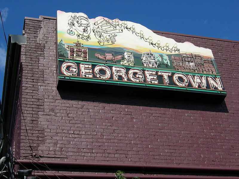
After a bit further a plane came SCREAMING overhead!  I bound across the bus to see where it was in bound for.  Sure enough we were by the Boeing Airfield south of downtown Seattle.  We pulled up at the first stop in Georgetown and I saw a cool music shop and next to it a coffee shop.  I then commenced to walk along the street in Georgetown and be wowed and the coolness of the area.  Absolutely loud, being sandwiched between an air field, the Interstate, multiple rail lines, and other industrial nitty gritty, but awesome atmosphere for rock n’ roll, biker bars, and the like.  Very rock star is what I’m saying.

I walked around for about 45 minutes and then headed onwards toward downtown.  That was my commute home for today, slightly different than the norm.  :)  Cheers!