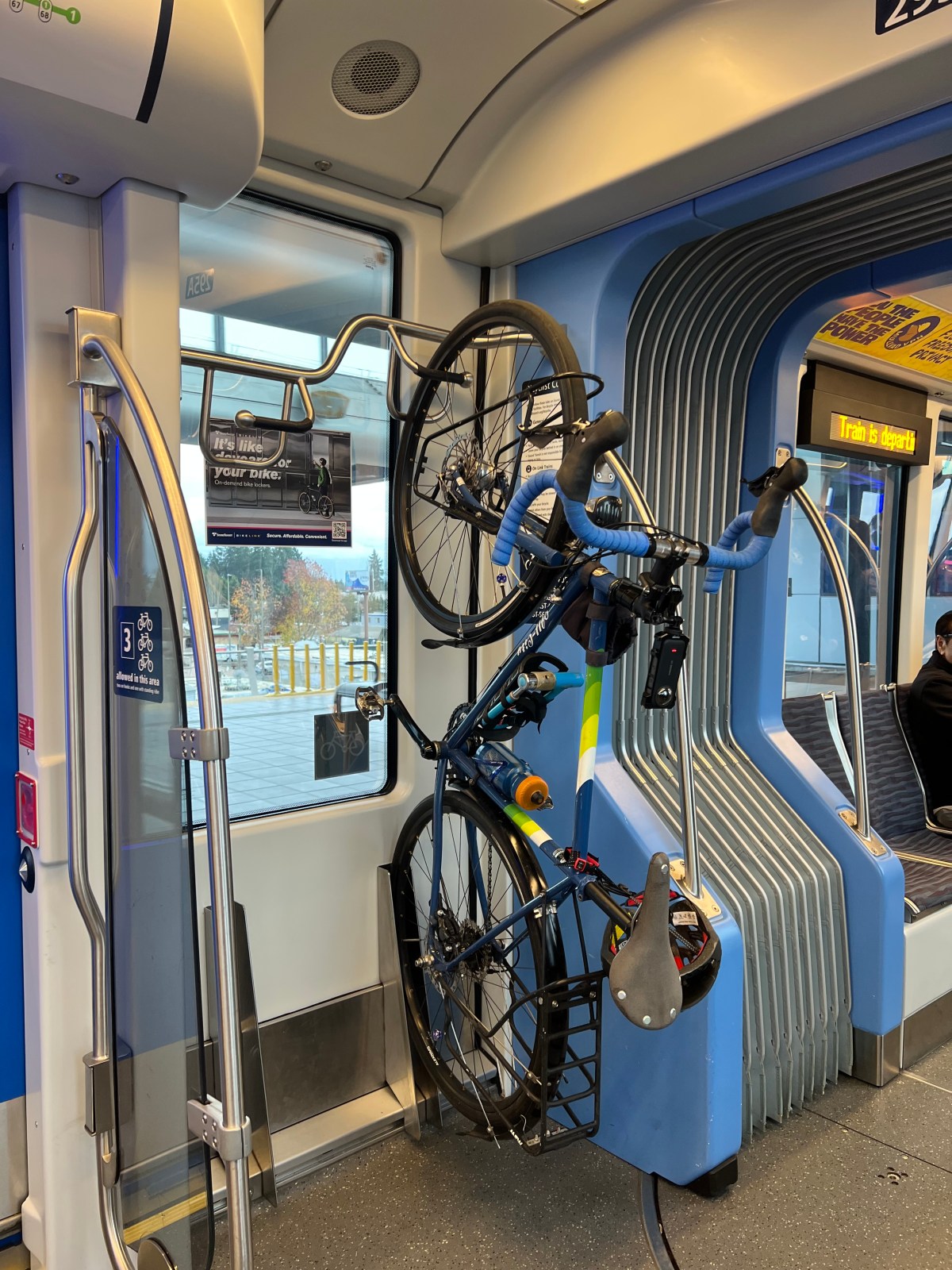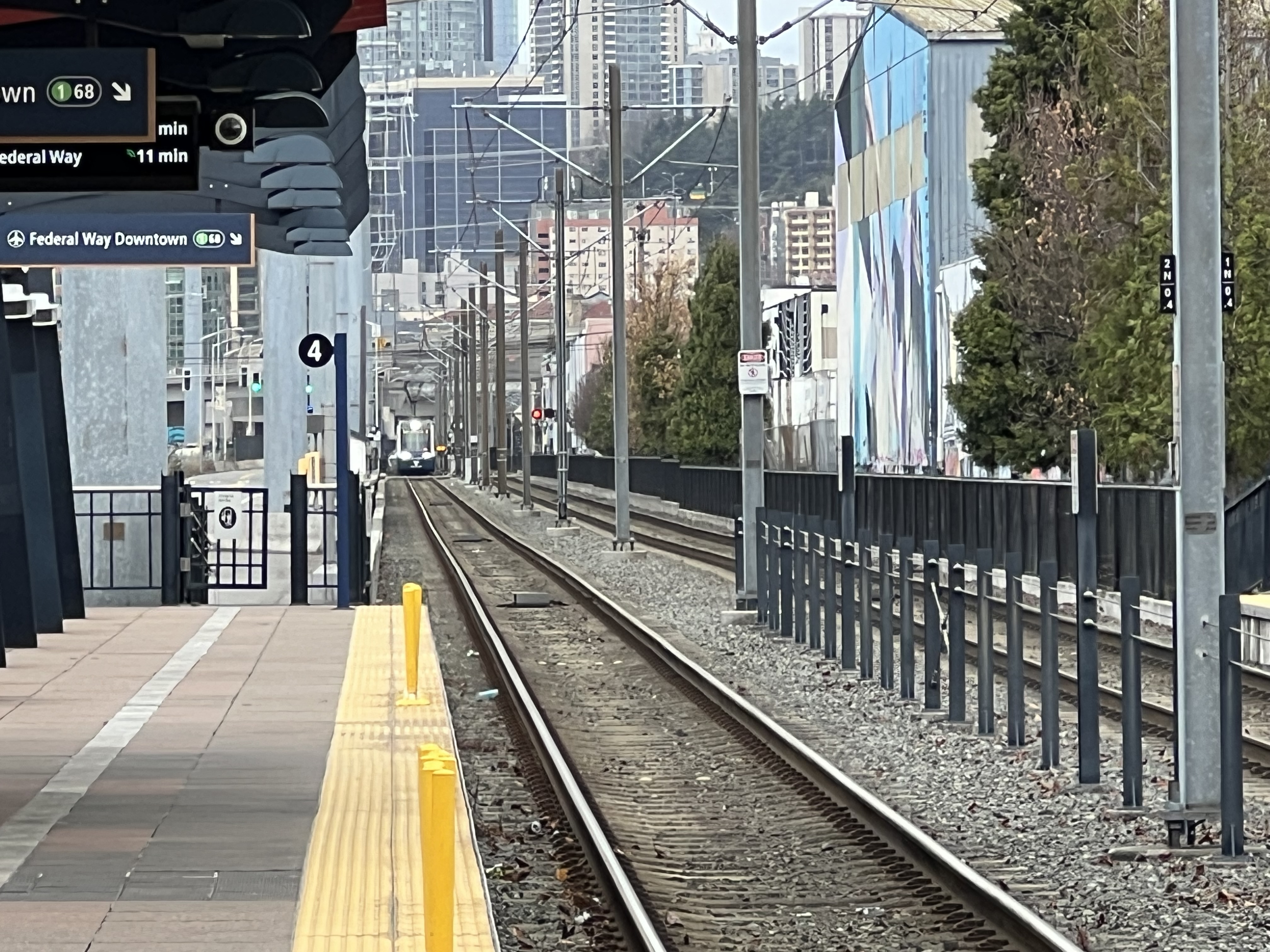
Light Rail!

Every Bus, Train, and Ferry in Puget Sound — On One Live Map

Every bus. Every train. Every ferry. Right now, moving, on one map.

Not a schedule. Not a “planned frequency” PDF. Not a rendering in some agency slide deck. The actual vehicles, where they actually are, this actual minute.

I found it at dashingarrivals.com, and I’ve lost an embarrassing number of minutes to it since. It’s a live map of the whole Puget Sound transit system — King County Metro, Sound Transit, Community Transit, Pierce, Kitsap, Everett, and the Washington State Ferries — all of it, all at once. On a weekday afternoon that’s north of 1,100 vehicles breathing across the screen. And yes, I’ve been sleuthing it. That’s the whole point of this blog, isn’t it.

The Whole Region, Live
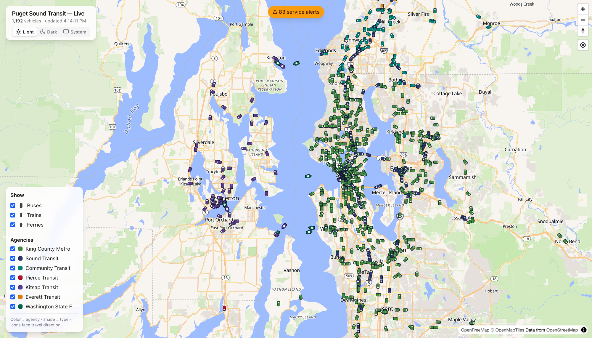
Here’s the thing that got me. Open it up and the region just… resolves. Green dots pour down the I-5 spine. Teal Community Transit coaches fan out across Snohomish County. Purple Kitsap buses cluster around Bremerton, and the ferries — the ferries — leave little wakes across the middle of the Sound like they’ve got somewhere to be. Which they do.

The legend is honest and simple: color is the agency, shape is the mode, and every icon points the way it’s traveling. That’s it. No account, no app store, no dark patterns. You just watch the region move.

Click a Boat, Meet the Tacoma
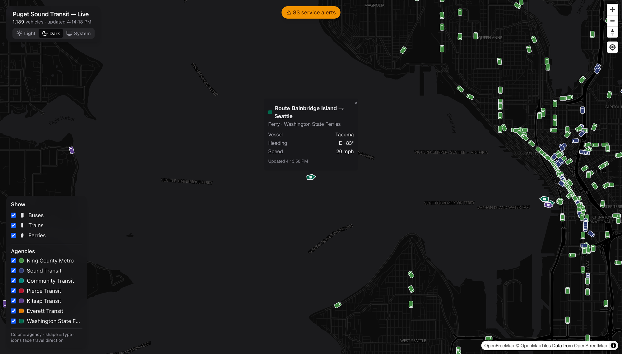
Tap any vehicle and it introduces itself. I clicked a green diamond mid-crossing and got the Tacoma — a Washington State Ferry, Bainbridge Island → Seattle, heading east at 20 knots. A named boat. I did not need that detail to live my life. I loved having it anyway.

Buses give you the coach number, trains give you the car, and everybody gives you heading, speed, and the last time they phoned home. It’s the kind of granularity that turns a map into a rabbit hole.

Show Me the Route

Every popup has a Show route link, and this is where I stopped being casual about it. Click it and the map draws that vehicle’s entire line — the shape and every stop — under the live vehicles still running it.
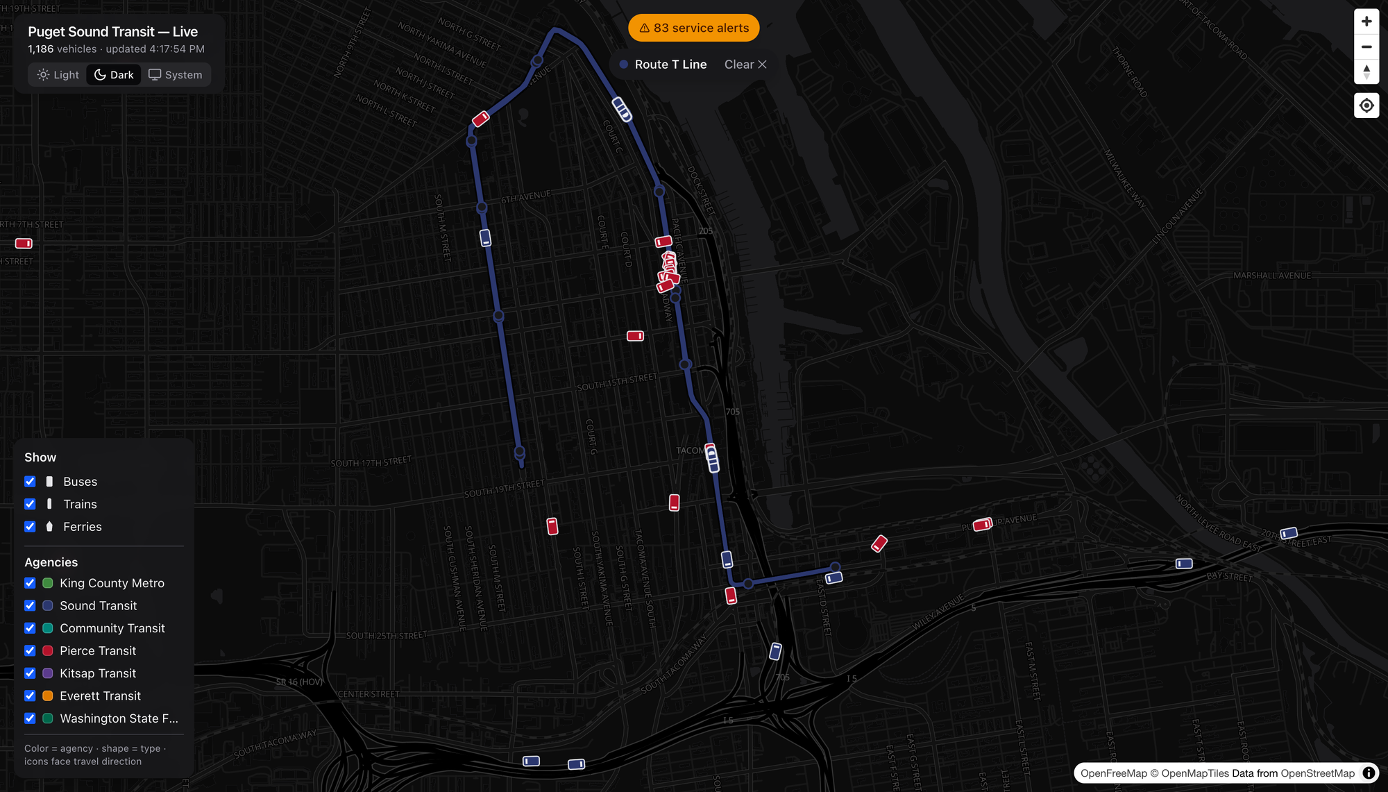
Watch the little T Line streetcar trace its loop through downtown Tacoma, red Pierce Transit coaches swarming around it. It’s a small system. It’s also real, and it’s on the map with everything else.

Rail That Isn’t Just Link

Here’s a public service announcement: the Puget Sound has more rail than most people riding it realize. Sounder is the one folks forget.
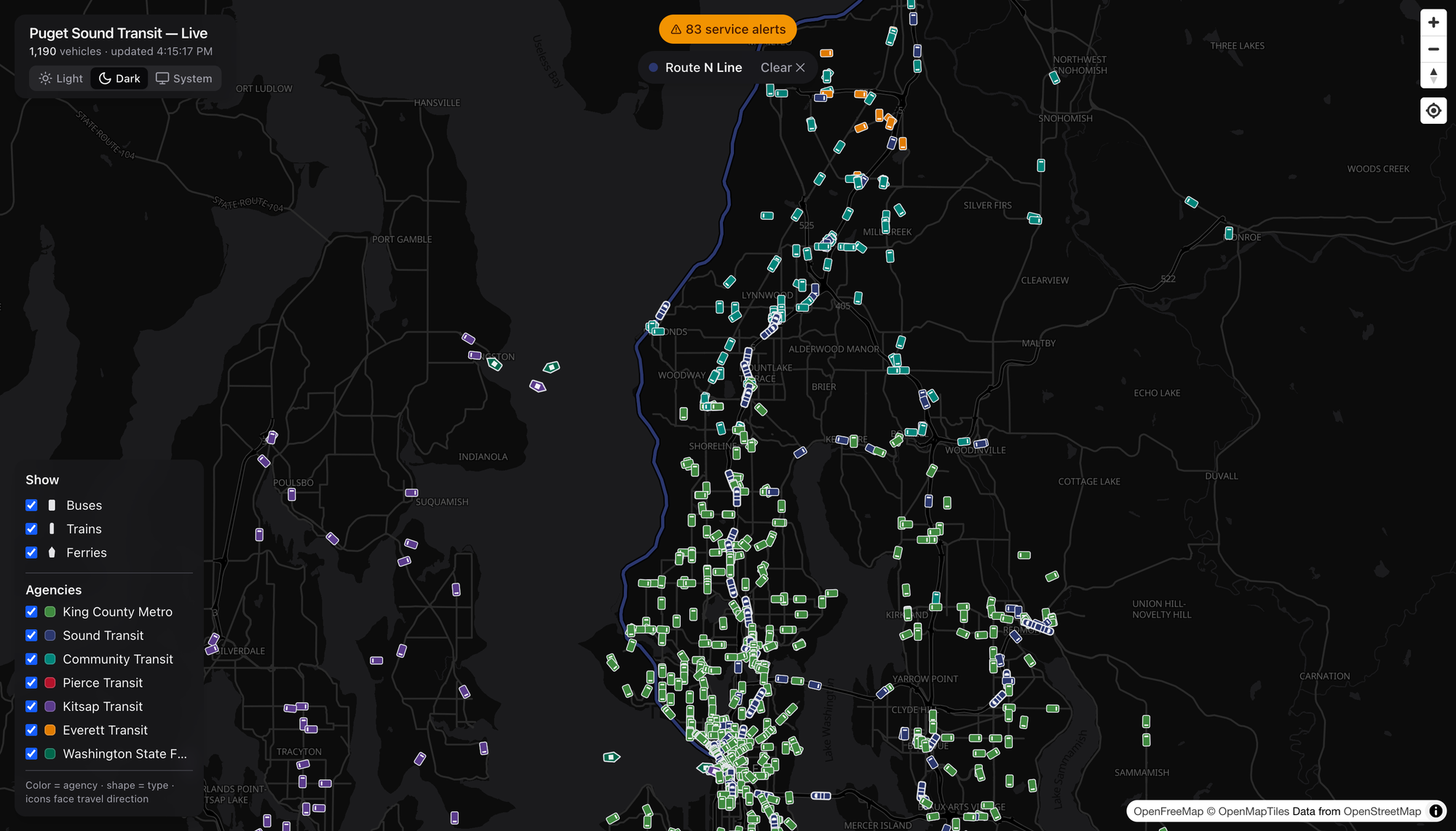
This is the N Line — Sounder commuter rail, Everett down to Seattle, hugging the water past Mukilteo and Edmonds. It only runs at the peaks, so catching a train on the map is a little reward for looking at the right hour. Pull the route up and the whole coastal alignment lights up, with Community Transit teal and Everett Transit orange filling in the last-mile around it. That’s a network — commuter rail doing the trunk, buses doing the capillaries.

Buses Get the Same Treatment

The route trick works for anything with wheels, which means you can finally see what a line actually does.
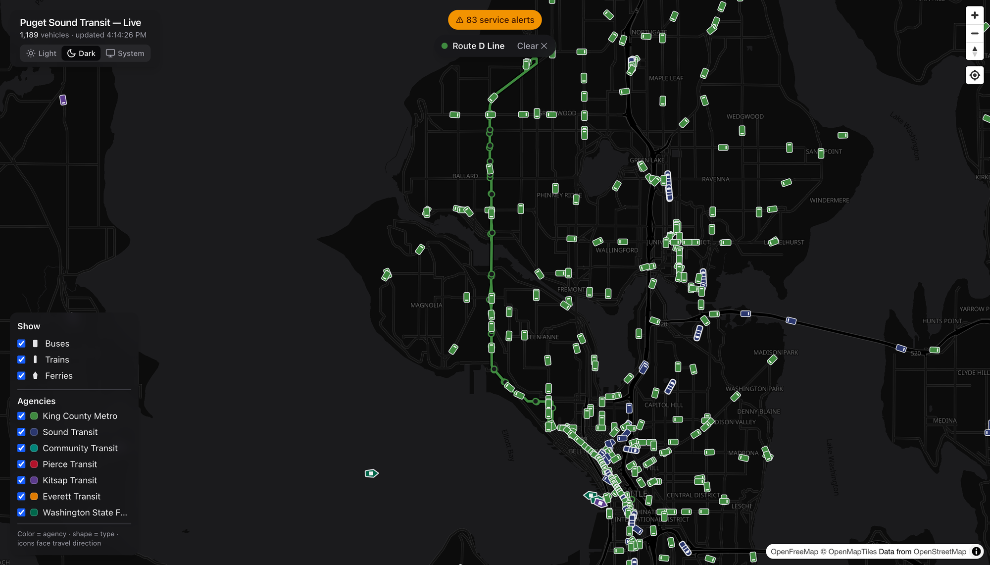
The RapidRide D Line in Metro green — Crown Hill and Ballard down through Interbay into downtown.
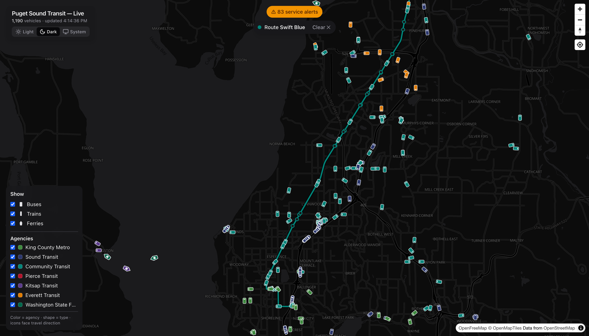
Community Transit’s Swift Blue in teal, running BRT straight down the old Highway 99 corridor from Everett to Shoreline — the kind of frequent, legible, get-on-and-go line I wish we built ten more of.
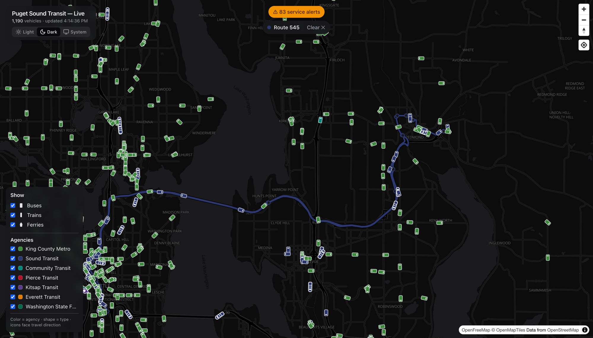
And the ST Express 545 in Sound Transit blue, humming across the 520 bridge to Redmond. Lettered RapidRide, numbered local, Swift, ST Express — pick any of them and the corridor lights up the same clean way.

Filter Down to One Agency

Eleven-hundred vehicles is a glorious mess. So dial it in.
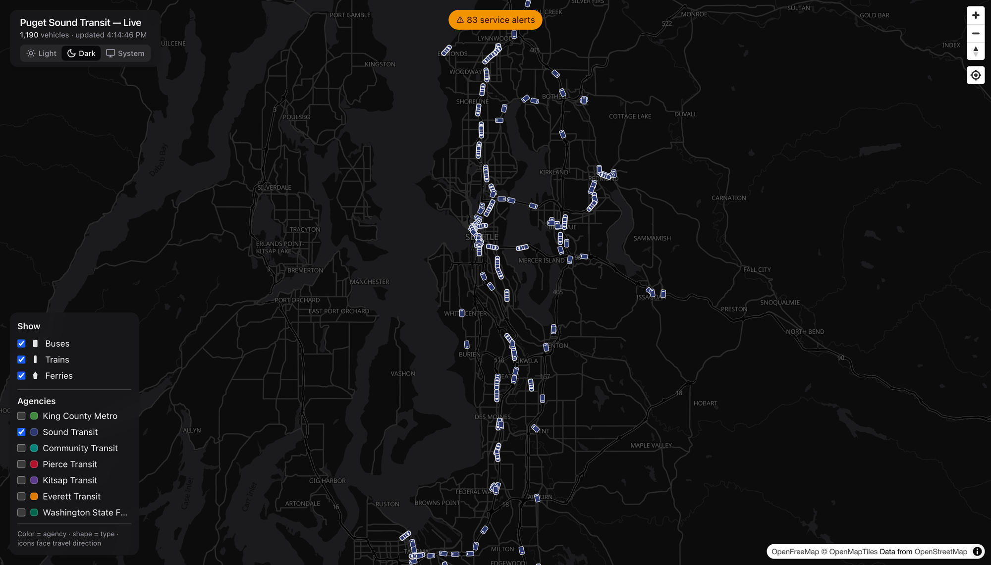
I unchecked every agency but Sound Transit, and there it is — the ST spider laid bare. Link threading north–south and across the lake, Sounder on the corridors, the T Line way down in Tacoma, ST Express filling the gaps to Redmond and Issaquah. One toggle and you’ve got the regional operator’s entire footprint, nobody else’s. Do the same with the modes and you can strip it down to just the boats if you want. (I want.)

When’s the Damn Bus
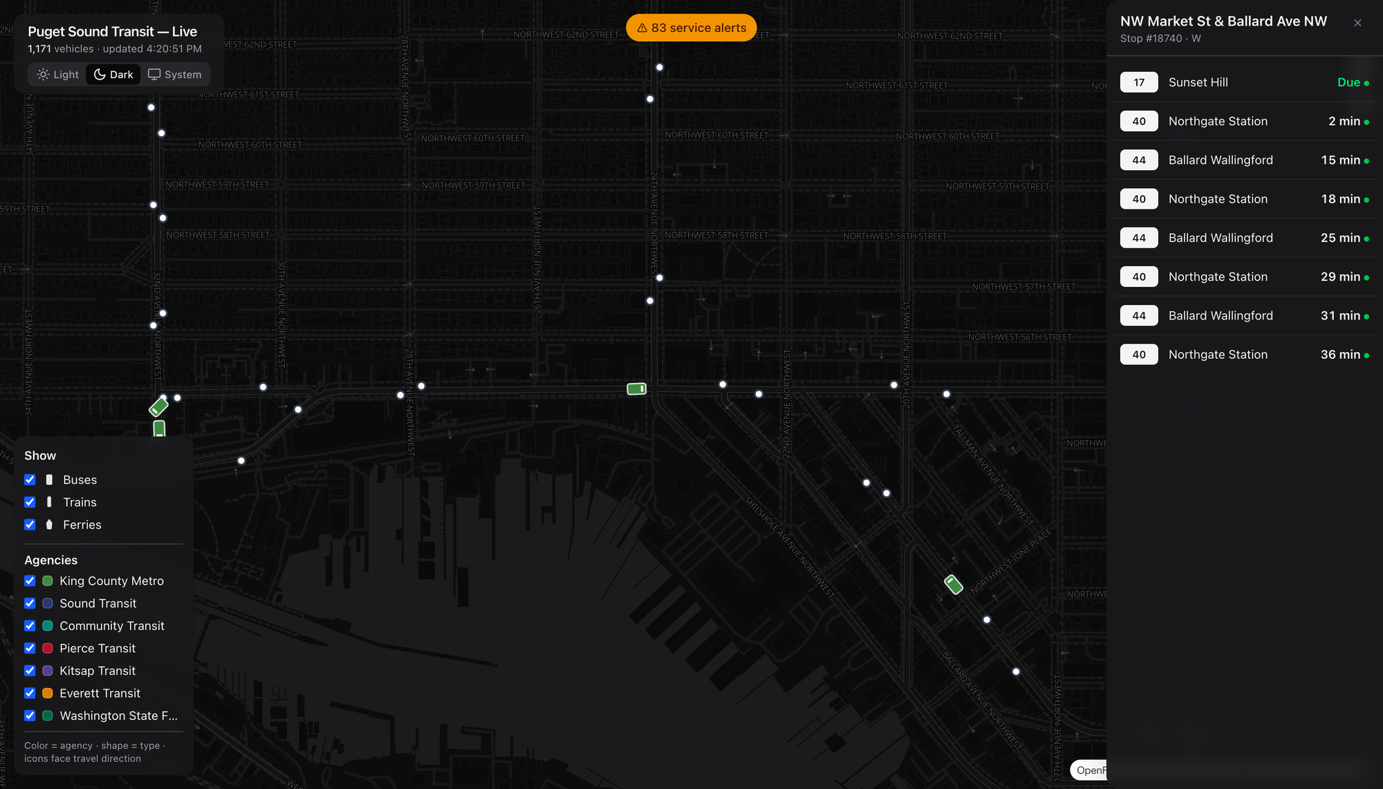
Zoom in and the stops appear. Click one — I grabbed NW Market & Ballard Ave — and you get a live arrivals board: the 17 to Sunset Hill due, a 40 to Northgate in two minutes, the 44 behind it. Real predictions with real countdowns, the same numbers you’d squint at on the sign, except you’re looking three blocks ahead before you leave the house. This is the part that’s actually useful, not just fun.

The Disruption Board
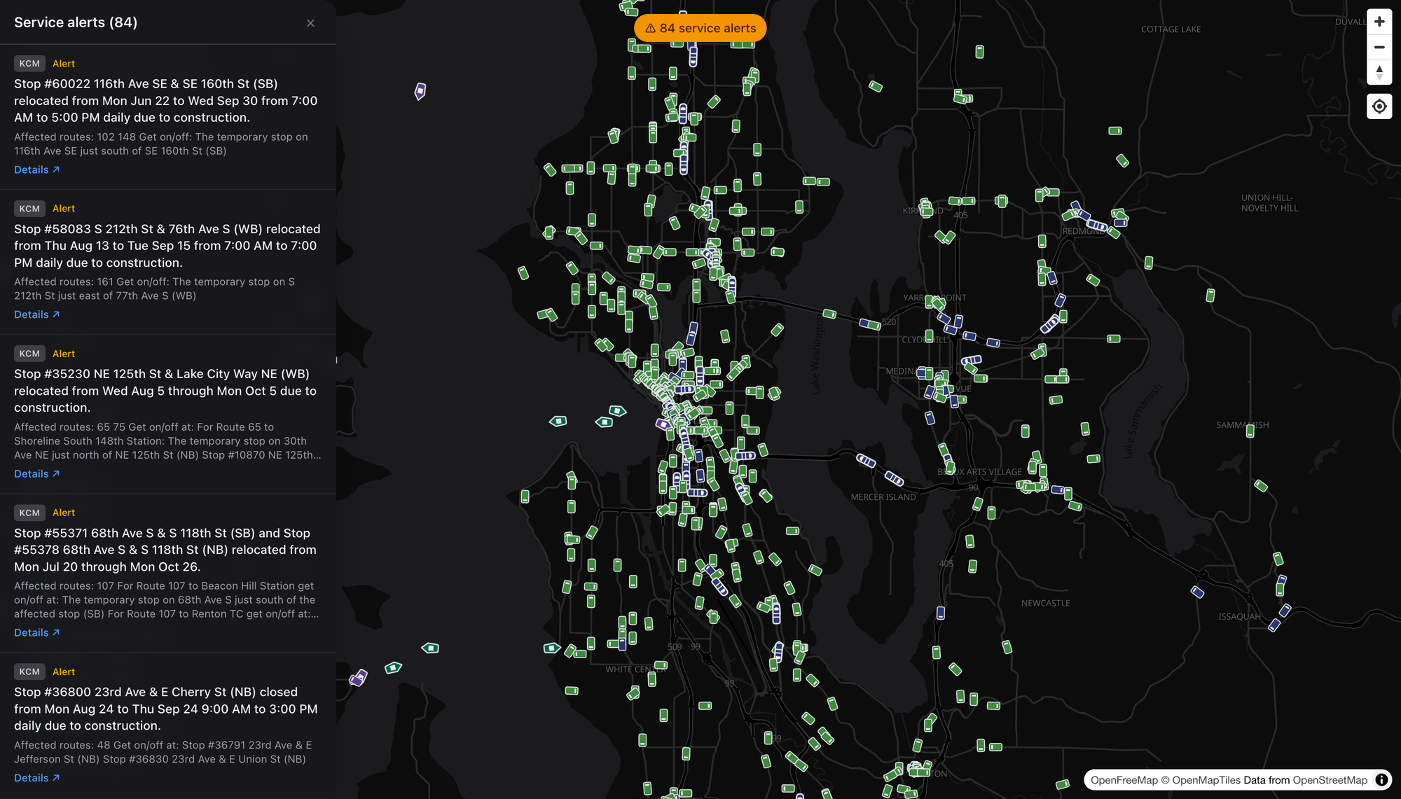
There’s a running count of active service alerts up top — reroutes, stop closures, construction, the usual regional churn — and opening it gives you every one, with the agency, the affected routes, and where to actually catch your bus in the meantime. It’s the “what’s broken right now” board for the whole Sound in a single scroll. Boring? Sure. Boring is exactly what you want from transit information.

Dark or Light, Reader’s Choice
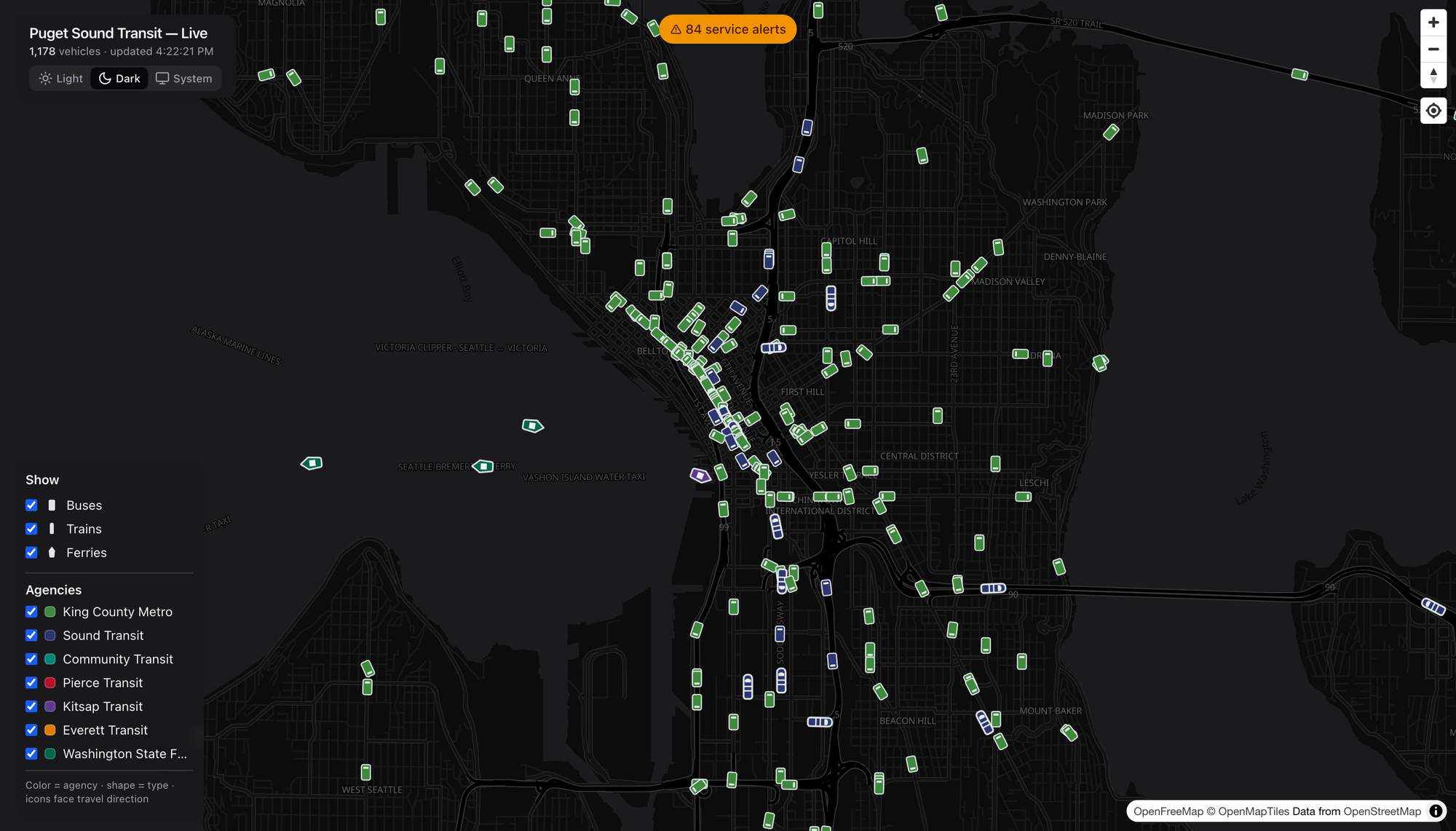
There’s a theme toggle — a crisp dark basemap for the night owls and vehicle-watchers, a bright one for daylight planning, and a System setting if you’d rather it just follow your machine. Same live data, different mood. I keep it dark. Obviously.

What I’d Watch

A few honest notes, because I can’t help myself:

  • Coverage is only as good as the feeds. This rides on the region’s OneBusAway data (plus WSDOT for the boats), so if an agency’s real-time feed hiccups, the map hiccups with it. Not the map’s fault — but it’s the ceiling.
  • Sounder and the T Line are peak-and-place dependent. Show up off-peak and the commuter rail is simply gone from the screen. That’s the schedule, not a bug, but a first-timer might not know to look at 5pm on a Tuesday.
  • This is a watcher’s tool that happens to be a rider’s tool. The arrivals and alerts make it genuinely practical, but the joy is in the whole-region view — and joy is a perfectly good reason for a thing to exist.

The Bottom Line

We spend a lot of energy in this country pretending transit is invisible — burying it under the regional asphalt car-sewer ritual until nobody can picture the network even existing. A map like this does the opposite. It makes the system legible. You can see, at a glance, that the Puget Sound already moves an enormous number of people by rail, bus, and boat every single minute of the day.

Go look. Click a ferry. Show a route. Find a stop near you and watch the next three buses roll toward it. Then go ride one — the best discoveries are always at the other end of a line you hadn’t tried yet.

Enjoy your day dear readers, cheers! 🚈

dashingarrivals.com


Screenshots grabbed live from dashingarrivals.com. Basemap © OpenFreeMap / OpenMapTiles, data © OpenStreetMap contributors. Real-time feeds via OneBusAway and WSDOT.
Lake Washington via Flanged Wheels

Finally.

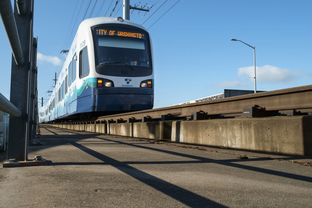
Another day riding light rail across the lake.

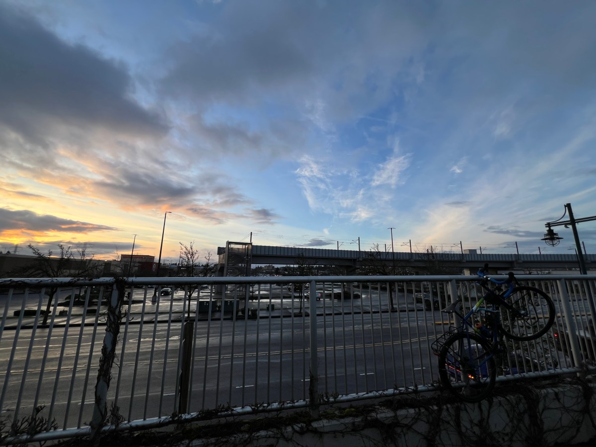
It’s a striking and beautiful day. The sun is out, visibility is out to the horizon. Which in Seattle and the surrounding metro means we get to see mountains in 300+ degrees of our view. We look west, the Olympic Mountains are clear and majestic. We look east, the Cascade Mountains are clear and majestic. We look south, Mount Rainier “The Mountain is out”. We look north and there are mountains. There isn’t a direction that isn’t absolutely stunning, majestic, and beautiful.

The light rail is reasonably full of folks, seats available in both directions across the lake. The train is quiet, people are reading, looking out the window, or chatting quietly. It’s a nice ride. Something one, knowing the Seattle & east side areas, would expect.

I’ve finished half my route and am heading back downtown to head north of downtown to work at a place called 3rd Place Books. If you’re curious about the reference in the name, check out this post.

Once I arrive there, will work, then have a lunch meeting with a friend, then head back to the light rail to head back home.

Then later in the day I’ll head back to the east side to pick up kiddo and repeat the cross lake excursion.

Scooter Mania

One of the things we do to cover the last mile segments of the trip is to use our scooters; I’ve got an electric one since I’m usually lugging around all our stuff, and he has an analog foot scooter. So basically kind of a skateboard with handlebars. It’s a fun way to get around and with the last mile gaps covered, it makes the trips pretty quick.

The People & Cultures

Riding the light rail I find it really cool to hear the announcements in multiple languages. Generally what I’ve heard is English, Spanish, and Mandarin. Prominent languages of the people in this area. I love that we’ve got a pretty solid mix of people and cultures, which we all share in this magnificently beautiful place.

Anyway, it’s a gloriously nice ride this morning and I just thought I’d share a quick blurb of a post. Enjoy your day dear readers, cheers!

Crazy Pho Cajun: A Fusion Stop Near the Federal Way Station

I rode the Link 1 Line down to Federal Way the other day. That’s what you do when new stations open, right? You check them out. You see what’s around them. You figure out if they’re actually useful. Or you determine if they are just in the middle of nowhere. Maybe they are in the middle of ticky tacky boring and uninspired suburban roads and sprawl. But at least you’ll know then to avoid any trips to those places! 🤣

Turns out, there’s actually something worth stopping for near the Federal Way Downtown station. It’s Crazy Pho Cajun. This place does exactly what the name suggests—mixes Vietnamese pho with Cajun food. It’s a weird combination, but sometimes weird combinations work.

The restaurant is right near the new light rail stop. This location makes it convenient if you’re coming from Seattle or anywhere else on the Link line. Let’s be honest. That’s part of the point of building transit. It gives people access to places they wouldn’t normally visit. This includes restaurants that blend two cuisines that don’t normally go together.

The Menu: Vietnamese Meets Louisiana

The menu is exactly what you’d expect from a place called Crazy Pho Cajun. You’ve got your traditional pho options. Then you’ve also got Cajun dishes like gumbo, red beans and rice, and etouffee. Then there’s the fusion stuff. One example is Cajun Crawfish Pho, which combines pho with crawfish tail meat. It also includes shrimp and andouille sausage. You can pick your spice level, which is nice if you’re not trying to burn your face off.

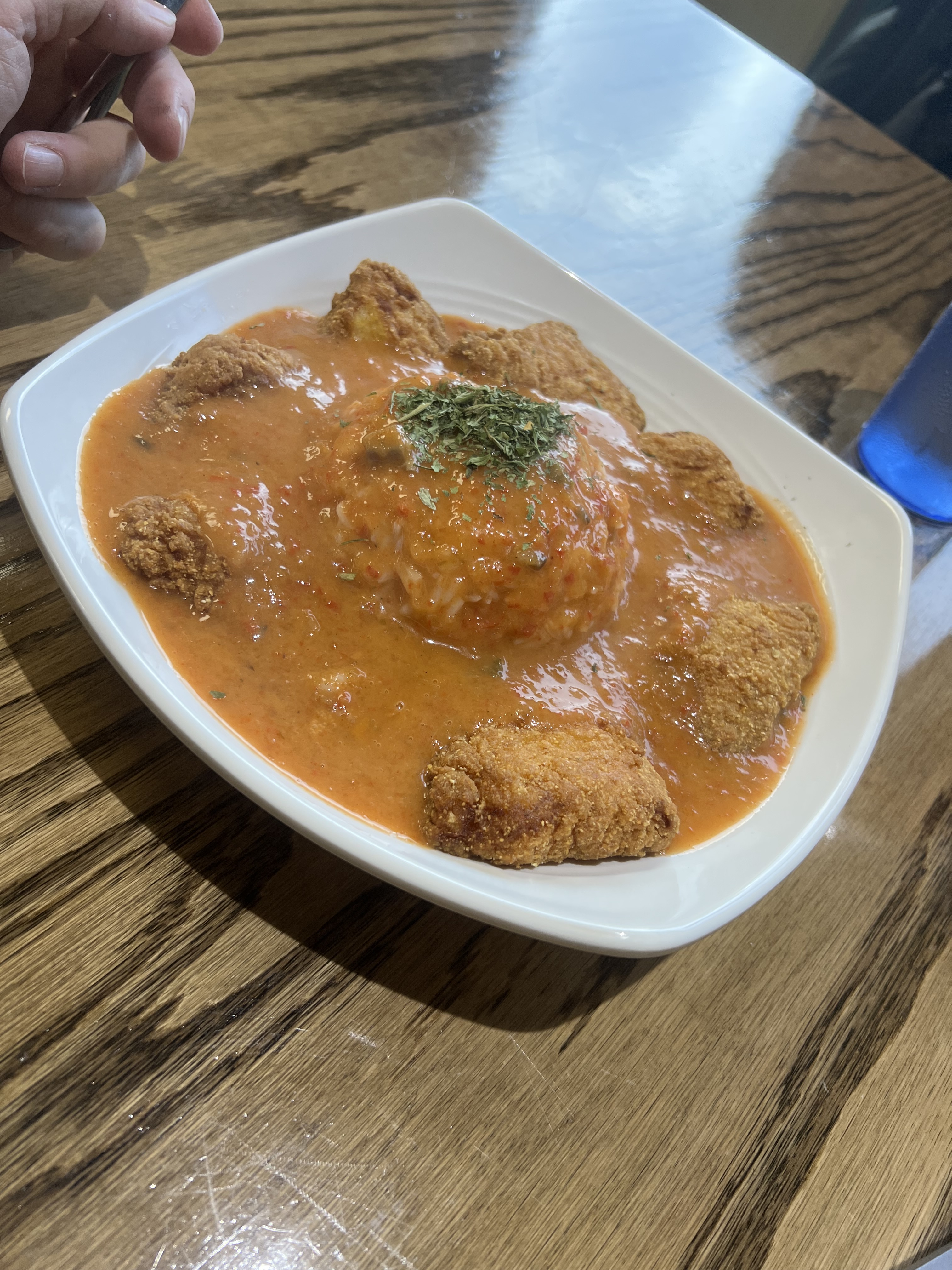
But here’s what I went for: the smothered catfish.

The Smothered Catfish

The smothered catfish is Cajun-battered fried catfish covered in a rich cream of etouffee, served over rice. It’s $11.95, which is reasonable for what you get. The catfish is crispy on the outside, tender on the inside—exactly how fried catfish should be. The etouffee sauce is creamy and flavorful, and it works with the fish in a way that makes sense.

Is it authentic Cajun? Probably not entirely. Is it authentic Vietnamese? Definitely not. But it’s good, and in the end that’s what matters. The fusion works because both cuisines have bold flavors, and they complement each other instead of fighting.

Why This Matters

Here’s the thing: Crazy Pho Cajun is exactly the kind of place that benefits from having a light rail station nearby. It’s a local restaurant that’s now accessible to people from all over the region. You can ride the train down from Seattle, grab lunch, and ride back. Transit-oriented development aims to connect people to places. It is not just about moving them from point A to point B.

The restaurant is casual, the staff is friendly, and the food is solid. It’s not fine dining, but it doesn’t need to be. It’s a good meal near a transit stop, and that’s valuable.

If you’re riding the Link 1 Line down to Federal Way, Crazy Pho Cajun is worth a stop. If you’re already in Federal Way and want to try something different, it’s a great choice. The smothered catfish is good, the fusion concept works, and it’s right there by the station. Sometimes the best discoveries are the ones you make because transit made them accessible.

For more details on their menu and offerings, check out their menu online.

The Extension Stops: Three New Stations on the Federal Way Link Extension

On December 6, 2025 (YESTERDAY!) Sound Transit’s Link 1 Line extended south with three new stations, pushing the light rail system deeper into South King County. These aren’t just stops on a map—they’re infrastructure investments that will reshape how people move through the region, and they tell us a lot about what Sound Transit thinks South King County needs.

Let’s talk about each of these stations, because they’re all different, they all serve different purposes, and they all represent different bets on what transit-oriented development looks like in the suburbs.

Kent Des Moines Station: The College Connection

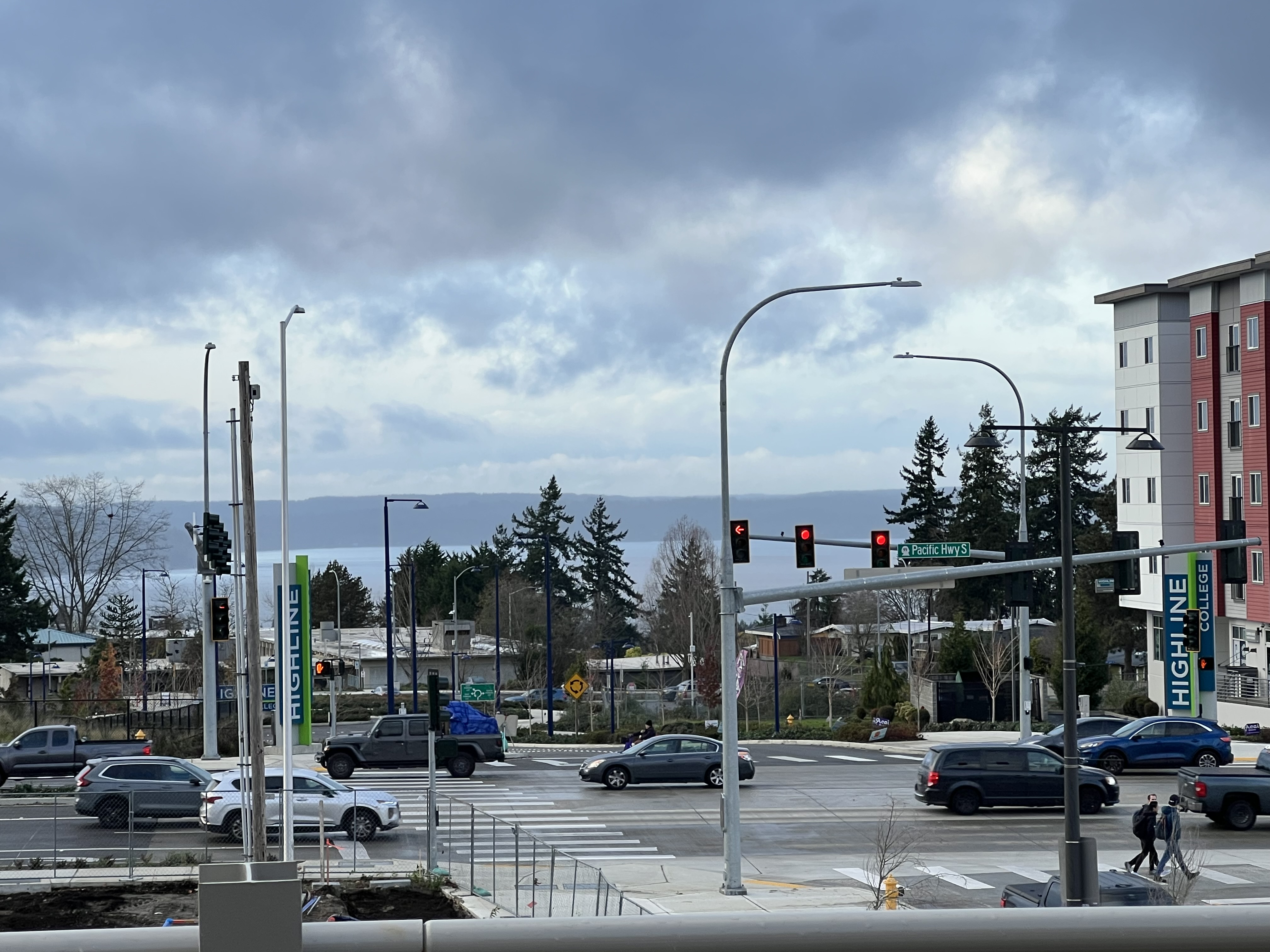
The first stop on the extension is Kent Des Moines Station, located east of I-5 at South 236th Street, right on the border between Kent and Des Moines. This is the station that serves Highline College, and that’s not accidental—colleges are transit goldmines. Students need to get to class, they don’t all have cars, and they’re willing to ride transit if it’s convenient.

The station is elevated, which means it’s above the street, and it includes a 500-space parking garage. That’s a lot of parking for a station that’s supposed to encourage transit-oriented development, but here’s the thing: South King County is car-dependent. You can’t just drop a light rail station in the middle of suburbia and expect people to walk to it. The parking garage is a necessary evil, a bridge between the car-centric present and the transit-oriented future.

What’s interesting about Kent Des Moines Station is what’s happening around it. Mercy Housing Northwest is building a 233-unit affordable housing project near the station, set to break ground this winter. This is the kind of transit-oriented development that actually matters—not just luxury condos for people who already have options, but housing for people who need transit because they can’t afford cars.

The station serves Highline College, which is good. But it’s also in an area that’s mostly residential, mostly suburban, and mostly not designed for walking. The station will work because of the college connection, but whether it becomes a true transit hub depends on whether the area around it develops into something more than parking lots and single-family homes.

Star Lake Station: The Interchange Hub

Star Lake Station, at South 272nd Street and 26th Avenue, is the big one. This is where Sound Transit is betting big on South King County’s transit future. The station acts as a key interchange for Link light rail, ST Express buses, and King County Metro services. It’s not just a light rail stop—it’s a transit hub.

The station includes a 1,100-space parking garage, replacing what was previously surface parking. That’s a lot of parking—more than double what Kent Des Moines has—and it tells you everything you need to know about how Sound Transit expects people to use this station. They’re driving to it, parking, and then taking transit. It’s a park-and-ride model, not a walkable urban center.

But here’s the thing: Star Lake Station is also a connection point. It connects to the existing freeway station, which means it’s serving people who are already using transit, just switching from buses to light rail. The station includes a new bike and pedestrian access path, which is nice, but let’s be honest—most people are driving to this station.

The 1,100 parking spaces are a statement. They’re Sound Transit saying, “We know you’re driving here, and that’s okay for now.” It’s a pragmatic approach to transit in the suburbs, where you can’t just expect people to walk to stations that are miles from their homes. But it’s also a missed opportunity. A station with 1,100 parking spaces is a station that’s designed around cars, not around people.

Star Lake Station will be busy. It’ll serve commuters heading north to Seattle and south to Tacoma. It’ll be a transfer point for people switching between buses and light rail. But it’ll also be a reminder that building transit in the suburbs means accommodating the reality of suburban life, even when that reality conflicts with transit-oriented ideals.

Federal Way Downtown Station: The Transit Center Anchor

Federal Way Downtown Station is the anchor of the extension, located at the Federal Way Transit Center—one of the busiest transit centers in the region. This isn’t just a new station; it’s an upgrade to an existing transit hub, and that makes it different from the other two stops.

The station adds 400 new parking spaces to the existing garages, which means there’s already parking infrastructure here. It includes public restrooms, which is notable because not all Sound Transit stations have them. And it’s part of a rebuilt street grid with pedestrian and bicycle improvements, which suggests that Federal Way is actually trying to create a walkable downtown around the station.

This is the station that has the most potential for real transit-oriented development. It’s in a downtown area, it’s already a transit hub, and the city is investing in making the area more walkable. The station area offers opportunities for affordable housing and sustainable development, and unlike the other two stations, this one might actually see that development happen.

Federal Way Downtown Station is what happens when you put light rail in a place that’s already thinking about transit. It’s not just a station dropped in the middle of suburbia; it’s a station that’s part of a larger plan to create a more urban, more walkable downtown. Whether that plan succeeds depends on a lot of factors—zoning, development, political will—but at least the foundation is there.

The station serves one of the busiest transit centers in the region, which means it’ll have high ridership from day one. People are already using buses here, and now they’ll have the option to take light rail. It’s an upgrade, not a new service, and that makes it more likely to succeed.

Federal Way Station

What These Stations Tell Us

These three stations represent three different approaches to transit in the suburbs:

Kent Des Moines is the college connection—a station that serves a specific destination (Highline College) and hopes to attract development around it. It’s a bet on transit-oriented development, but it’s starting from a suburban baseline.

Star Lake is the park-and-ride hub—a station designed around cars, with massive parking capacity and connections to other transit services. It’s pragmatic, but it’s also a reminder that building transit in the suburbs means accommodating car culture.

Federal Way Downtown is the urban anchor—a station in an existing transit hub that’s part of a larger plan to create a walkable downtown. It has the most potential for real transit-oriented development, but it also requires the most coordination between Sound Transit and the city.

All three stations are elevated, which means they’re above the street, not at grade. This is expensive, but it also means the trains don’t have to deal with traffic, which keeps service fast and reliable. It’s the right choice for a high-capacity transit line, even if it makes the stations feel less integrated with the street level.

All three stations include parking garages, which tells you that Sound Transit knows people will drive to these stations. That’s the reality of suburban transit—you can’t just build stations and expect people to walk to them from miles away. But it’s also a compromise, a recognition that transit-oriented development takes time, and in the meantime, you need to serve the people who are already here.

The Future

These stations open in December 2025, and they’ll immediately change how people move through South King County. But whether they become true transit hubs or just park-and-rides depends on what happens around them. Transit-oriented development isn’t automatic—it requires zoning changes, developer interest, and political will.

Kent Des Moines has affordable housing planned, which is a good sign. Star Lake has massive parking, which suggests it’ll be a commuter hub. Federal Way Downtown has the most potential for real urban development, but it also requires the most coordination.

These three stations are the latest extension of the Link 1 Line spine, pushing deeper into South King County and connecting more people to the regional transit system. They’re not perfect—they’re compromises between transit ideals and suburban reality—but they’re progress. And in a region that’s slowly rebuilding the transit infrastructure it tore up decades ago, progress matters, even when it’s imperfect.

The extension stops are here. Now we’ll see what grows around them.

Further Reading

If you want more context on Sound Transit’s expansion efforts, I’ve written about the agency’s growth on Transit Sleuth:

These posts offer a broader perspective on Sound Transit’s ongoing expansion efforts, from the Eastside Link extension to the system-wide growth that’s reshaping how people move through the Puget Sound region. The Federal Way extension is just one piece of a much larger puzzle, and understanding the full picture helps put these three new stations in context.

Sound Transit and the Link 1 Line: Building a Spine Instead of a Network

The Intent and Purpose of Link 1 Line

Sound Transit’s Link 1 Line is the backbone of Seattle’s light rail system—a 40-plus mile north-south corridor that connects Lynnwood in the north to Federal Way in the south (with eventual extensions planned to Everett and Tacoma). The line serves as a high-capacity transit artery, connecting major employment hubs, residential areas, and key destinations like downtown Seattle, the University of Washington, and Sea-Tac Airport.

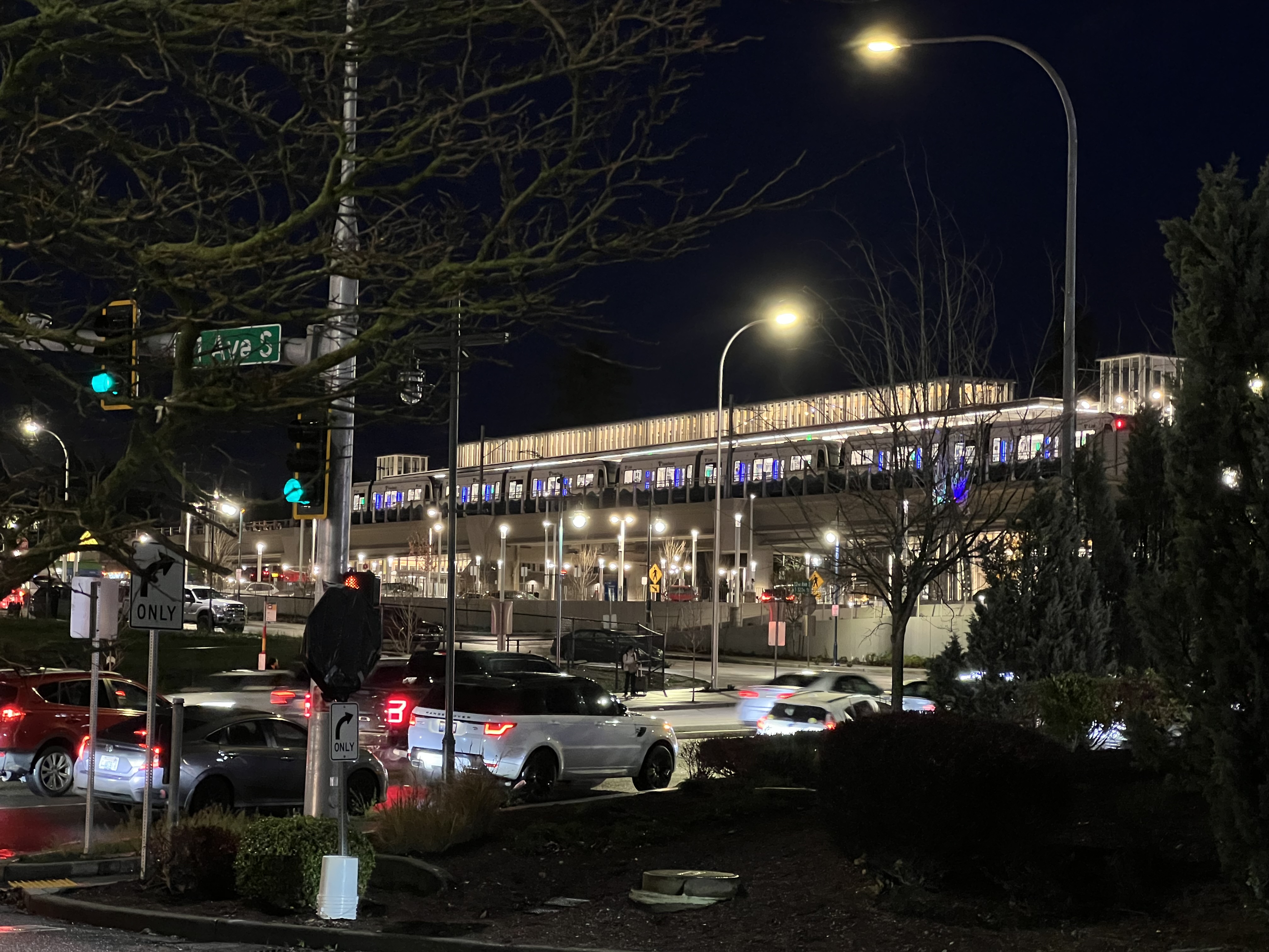
My ride to the extension opening!

The intent is straightforward: provide a reliable, high-capacity transit option that operates independently of road traffic, offering consistent travel times and encouraging people to leave their cars behind. It’s electric, it’s fast, and it’s designed to move tens of thousands of people daily along the region’s most congested corridor.

But here’s the thing: Link 1 Line isn’t just a transit line—it’s a strategic choice. It’s built as a spine, a single continuous line that runs north-south, rather than as a network of intersecting light rail lines like Portland’s MAX system. This decision, and the agency that made it, tells us a lot about how Seattle approaches regional transit.

Sound Transit: An Odd Creature of Washington State Politics

Sound Transit, officially the Central Puget Sound Regional Transit Authority, was created in 1993 by the Washington State Legislature. But here’s where it gets interesting: Sound Transit isn’t your typical transit agency. It’s a special-purpose district with taxing authority, created specifically because the region needed a way to fund and build transit infrastructure that crossed multiple county and city boundaries.

The political structure is, frankly, weird. Sound Transit’s board consists of 18 members—elected officials from King, Pierce, and Snohomish counties, plus representatives from the cities within the transit district, and the Washington State Secretary of Transportation. This means the agency is governed by politicians who have other jobs, other constituencies, and other priorities. It’s not a directly elected transit board like some cities have; it’s a collection of mayors, county executives, and council members who happen to also make transit decisions.

This structure was created because the region needed a way to coordinate transit across jurisdictional boundaries. Individual cities couldn’t build regional transit on their own. King County Metro could run buses, but building light rail that connected Everett to Tacoma required something bigger—something that could collect taxes across multiple counties and make decisions that served the region, not just individual cities.

The Tax Revenue Collection Model: Voter-Approved Everything

Sound Transit’s funding model is unique, and it’s both a strength and a weakness. The agency relies on voter-approved taxes within its service district, which includes parts of King, Pierce, and Snohomish counties. These taxes include:

  • Sales Tax: 1.4% sales tax on purchases within the district
  • Motor Vehicle Excise Tax (MVET): 0.8% tax on vehicle registrations
  • Rental Car Tax: 0.8% tax on rental cars
  • Property Tax: Up to 25 cents per $1,000 of assessed value (with annual increases capped at 1%)

This funding structure means Sound Transit has a dedicated revenue stream, but it also means every major expansion requires going back to voters. The agency can’t just decide to build something—it has to convince voters to approve the taxes to pay for it. This has led to a pattern of phased expansion: Sound Transit goes to voters with a package, gets approval, builds what it promised, then goes back years later for the next phase.

The 1996 “Sound Move” ballot measure created the agency and funded the initial light rail line. The 2008 “ST2” measure extended the system. The 2016 “ST3” measure approved the massive expansion that’s currently being built. Each time, voters had to approve new taxes, and each time, the agency had to deliver on its promises before asking for more.

This creates a conservative, incremental approach to transit expansion. Sound Transit can’t be too ambitious because it has to win elections. It can’t move too fast because it has to prove it can deliver. And it can’t easily change course because major decisions are locked into voter-approved packages.

Why a Spine Instead of a Network?

The decision to build Link 1 Line as a spine—a single north-south line—rather than a network of intersecting lines like Portland’s MAX system, was driven by several factors, some practical and some political.

Geographic Reality: Seattle’s topography is challenging. Water, hills, and valleys create natural barriers. Building a single spine along the I-5 corridor makes sense because that’s where the people are, where the jobs are, and where the existing transportation infrastructure already exists. A grid system would require crossing Lake Washington, tunneling through hills, and dealing with terrain that makes multiple intersecting lines expensive and complex.

Resource Concentration: Sound Transit’s funding model—dependent on voter approval and limited tax revenue—meant the agency had to maximize impact with limited resources. Building one high-capacity spine that serves the highest-demand corridor makes more sense than spreading resources across multiple lines. One line with high ridership is better than multiple lines with lower ridership, at least from a cost-per-rider perspective.

Phased Expansion Strategy: The spine serves as a foundation. Once you have a strong central line, you can branch off from it. Future lines can connect to the spine, creating a network over time. But you start with the backbone, the thing that connects the major destinations, and build from there.

Political Compromise: The spine connects Everett, Seattle, and Tacoma—the three major cities in the region. This wasn’t accidental. To get voters in all three areas to approve taxes, Sound Transit had to promise service to all three. A single spine that serves all three cities was the political solution: everyone gets something, everyone pays, and the line serves the highest-demand corridor.

Operational Simplicity: A single line is easier to operate, easier to maintain, and easier to expand incrementally. You don’t need complex interchanges, you don’t need to coordinate multiple lines, and you can add capacity by running more trains on the same track. It’s simpler, and simplicity has value when you’re building something this complex.

The Portland Comparison

Portland’s MAX system is different. It’s a network of intersecting lines that form a grid-like pattern across the metro area. The Blue Line, Red Line, Green Line, Yellow Line, and Orange Line all intersect and connect, giving riders multiple ways to get from point A to point B.

Portland’s system works because Portland is flatter, has fewer geographic barriers, and was planned as a network from the start. The city’s urban growth boundary and land-use planning created a more compact, transit-friendly development pattern. And TriMet, Portland’s transit agency, had different funding mechanisms and political structures that allowed for a more network-oriented approach.

Seattle’s spine approach makes sense for Seattle’s geography, politics, and funding model. But it also means the system is less flexible. If you want to go east-west, you’re out of luck until Sound Transit builds those lines (which it’s doing, slowly, with the 2 Line to Bellevue and Redmond). If you’re not near the spine, you’re not getting light rail service.

The Trade-offs

Building a spine instead of a network has consequences. The spine serves the highest-demand corridor well, but it leaves other areas underserved. It’s efficient for north-south travel, but it doesn’t create the kind of network coverage that makes transit truly convenient for everyone.

Sound Transit is addressing this, gradually. The 2 Line will branch east to Bellevue and Redmond. Future lines are planned. But the spine-first approach means it takes decades to build a comprehensive network, and in the meantime, large parts of the region are left without high-capacity transit.

The funding model compounds this. Because Sound Transit has to go to voters for every major expansion, progress is slow. The agency can’t just decide to build a new line—it has to wait for the next ballot measure, convince voters to approve it, then spend years building what was approved. This creates a cycle of incremental expansion that, while politically sustainable, doesn’t move as fast as the region’s growth demands.

The Future

Link 1 Line is growing. Extensions to Everett and Tacoma are planned. The 2 Line is opening. More lines are in the works. But the spine-first strategy means Seattle’s light rail system will always be fundamentally different from Portland’s network approach.

Is that good or bad? It depends on what you value. The spine serves the highest-demand corridor efficiently. It’s a solid foundation for future expansion. And it reflects the political and geographic realities of the Puget Sound region.

But it also means that, for now, Seattle’s light rail system is less comprehensive than it could be. It serves some people very well and others not at all. It’s a backbone, but it’s not yet a network.

Sound Transit’s odd structure—its voter-approved taxes, its board of politicians, its incremental expansion model—created this spine. And that spine is both a testament to what’s possible when a region commits to transit and a reminder of the compromises that come with building transit in a complex political environment.

The Link 1 Line is impressive. It’s also incomplete. And that’s the story of Sound Transit: ambitious enough to build something remarkable, constrained enough that it takes decades to finish (or in many cases even start) the job.