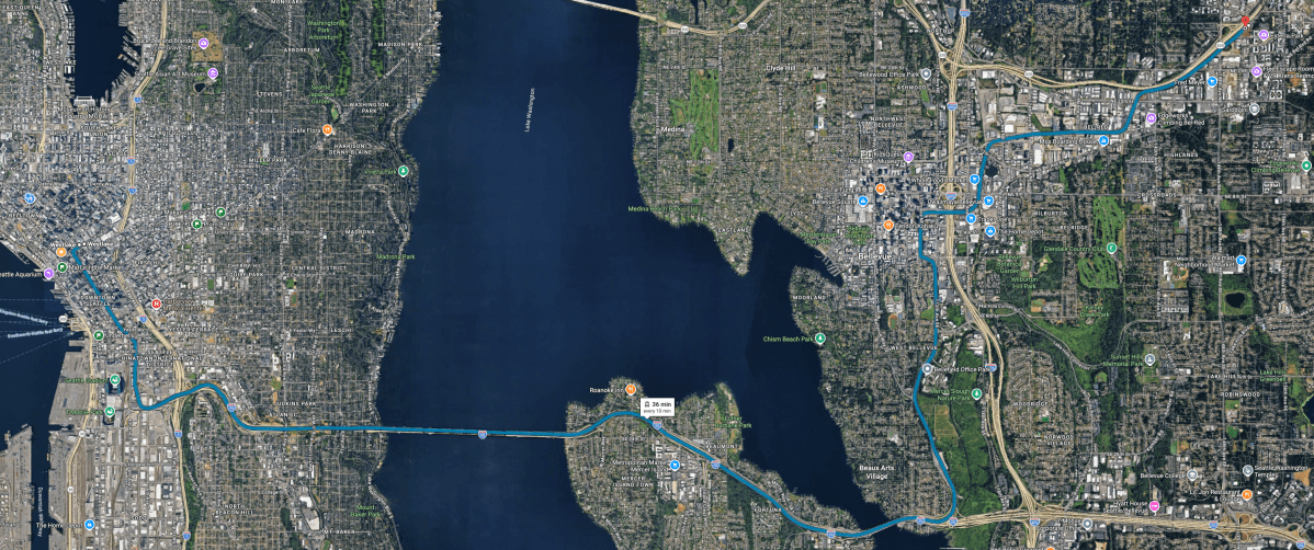
Not “rendering in a Sound Transit planning deck” real. Not “sometime after the next delay” real. Real as in: board a Link train, cross the I-90 floating bridge, get off on the other side, and go about the rest of your day without negotiating with traffic on 520, I-90, Bellevue Way, Mercer, or whatever other regional asphalt car sewer ritual the day was threatening.
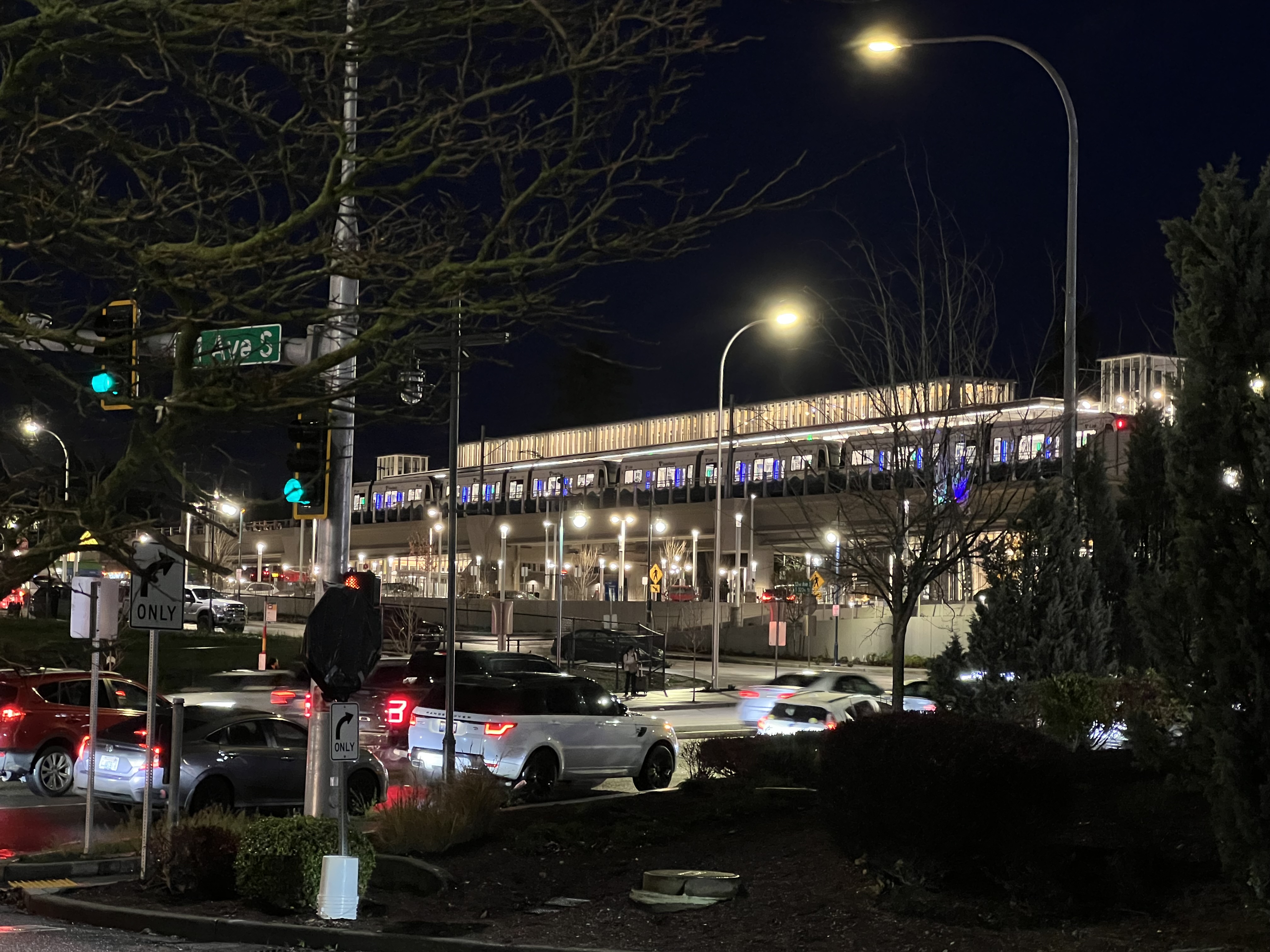
Sound Transit opened the Crosslake Connection on March 28, 2026, completing the 2 Line and connecting Redmond, Bellevue, Mercer Island, Judkins Park, downtown Seattle, and Lynnwood into one operating line. The agency notes that this brings the Link system to 63 miles and 50 stations.
That is a big system now. Not a theoretical one. Not a “starter line.” A real regional rail spine with two overlapping lines through the Seattle core.
And technically, the cross-lake segment is the interesting bit. This is light rail running across a floating bridge, in passenger service, over Lake Washington. That is not normal. That is not a thing most rail systems have to solve. It is the kind of civil and systems engineering problem that sounds like a dare.
The Alignment Is the Feature
The 2 Line’s new connection is just a handful of miles, but it changes the entire topology of the system and the key areas that the Link system connects is substantial. Bellevue for example is a city center and a surrounding population of about 150k people and then beyond that is Redmond, a city that has a population around 90k.
Before the cross-lake opening, the Eastside segment was useful but isolated. It was a nice rail line doing Eastside things, but operationally it was not yet part of the regional pattern most riders think about when they think “Link.” Once the I-90 segment opened, the line stopped being a segment and became a network connection.
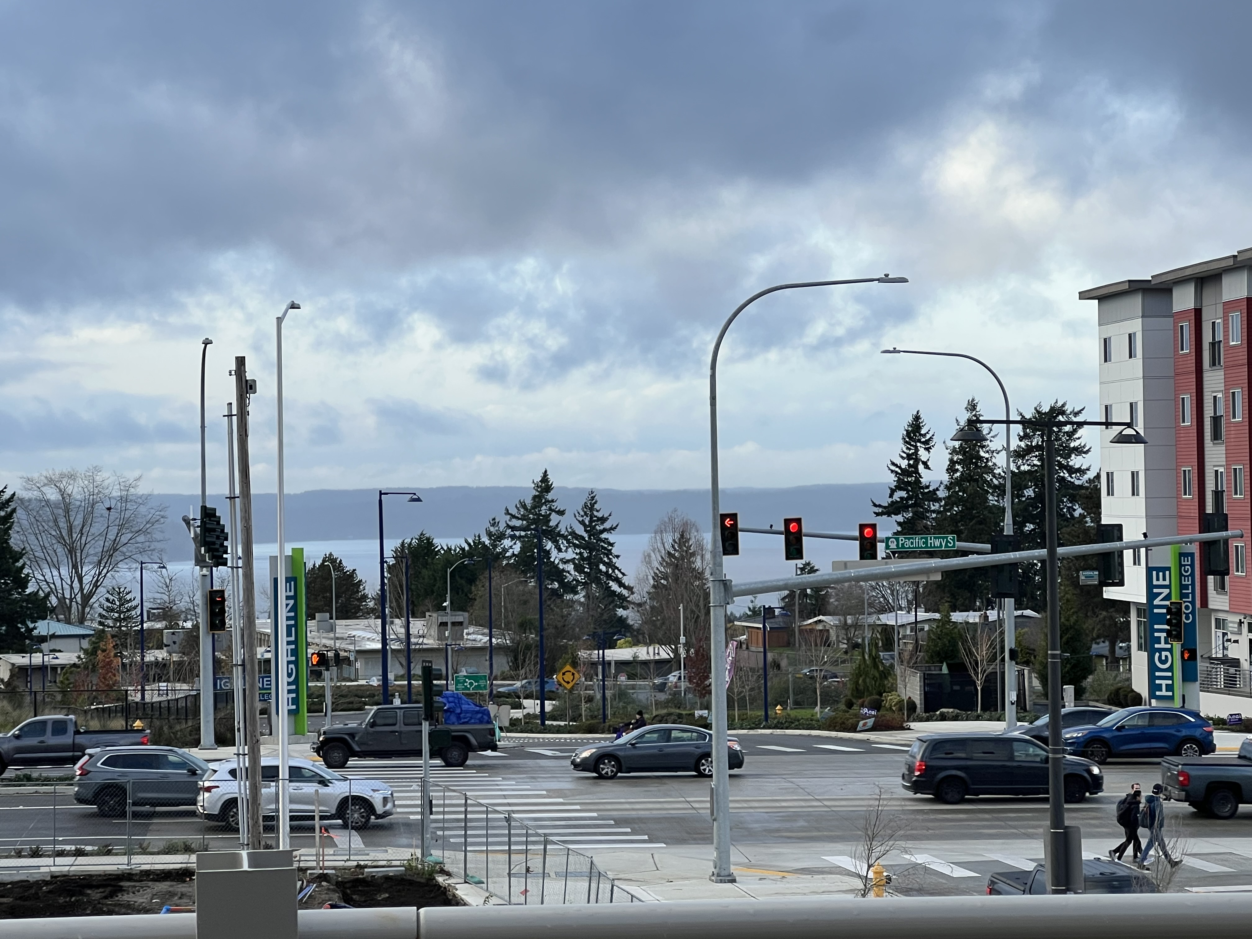
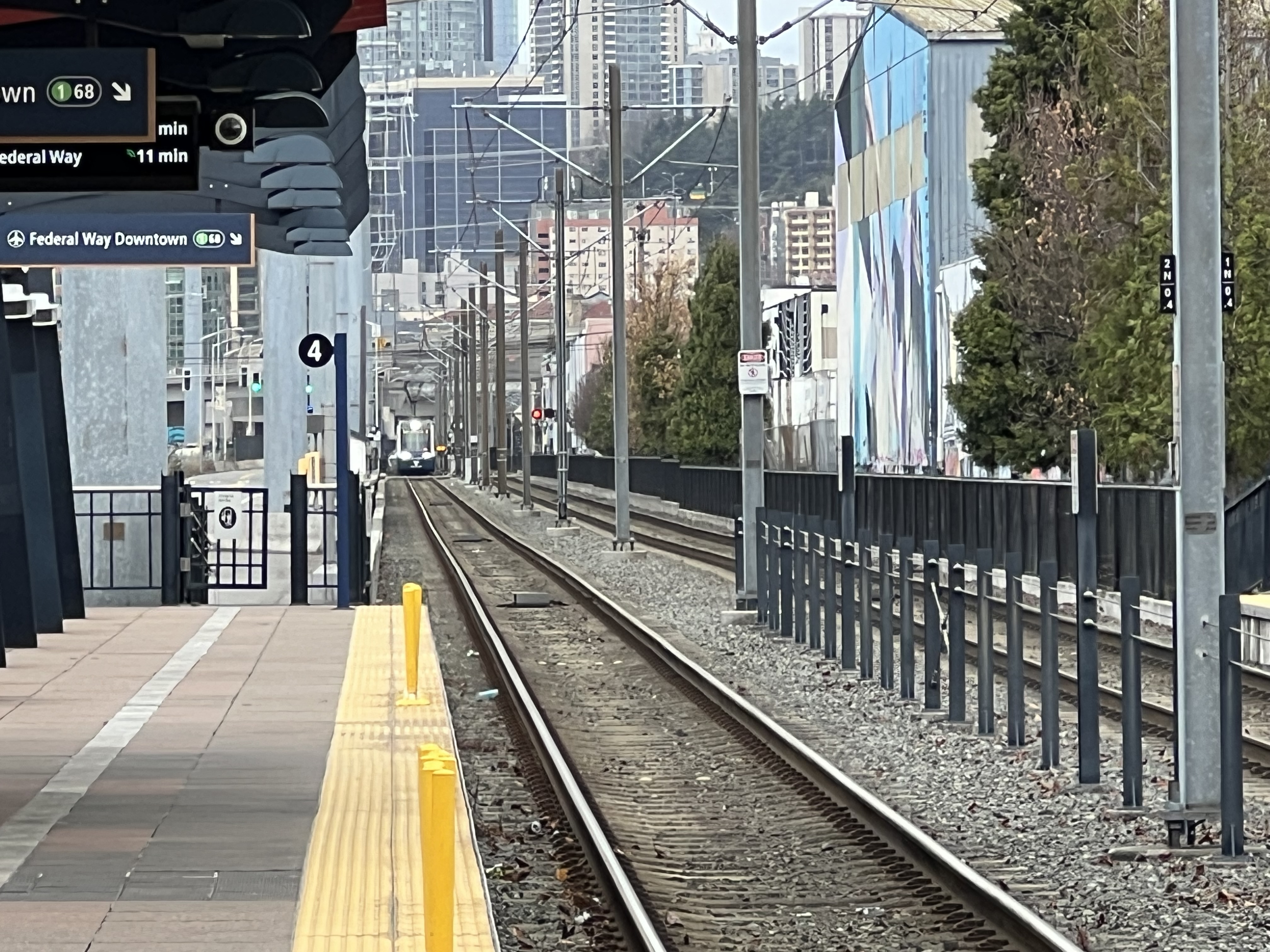
The trip from Bellevue or Redmond to Seattle is now a rail trip, not a bus-to-traffic probability exercise. Mercer Island is no longer just a park-and-ride transfer geography. Judkins Park becomes a real rail access point for the Central District and I-90 corridor. International District/Chinatown becomes the key hinge where the 1 Line and 2 Line overlap and then split.
Sound Transit says peak service at the new stations runs about every eight minutes, with 10-15 minute service the rest of the day. Between Lynnwood City Center and International District/Chinatown, the 1 and 2 Lines interline for roughly 4-5 minute headways. That is the important operational detail. The cross-lake opening is not just a new branch. It adds frequency through the shared trunk.
The Floating Bridge Part Is Still Wild
The engineering problem here is not “put tracks on bridge, run train, enjoy lake views.”
Floating bridges move. They flex. They rise and fall. They respond to wind, water, traffic loading, temperature, and the general reality that Lake Washington is not a static CAD file. Rail, meanwhile, is not fond of sudden geometry changes. Steel wheels on steel rail want alignment, predictable tolerances, smooth transitions, and electrical systems that do not behave like someone built them during a team offsite.
That is why this segment took real systems integration work. Sound Transit spent 2025 moving from unpowered tow testing to powered testing, pre-revenue operations, simulated service, and then passenger service. That progression matters because rail openings are not just construction completion. They are operational proof. The train has to work as a vehicle, as part of the signaling system, as part of the power system, as part of the operator training regime, and as part of the daily schedule. Even when it seems simple – and that’s the aim – it really is much more complex than that!
Crossing the bridge feels smoother than the engineering challenge would suggest, which is exactly what good infrastructure should do. The public experience should be boring in the operational sense. The extraordinary part should disappear under the regularity of service.
The Vehicles: Familiar Link Hardware, New Operating Pattern
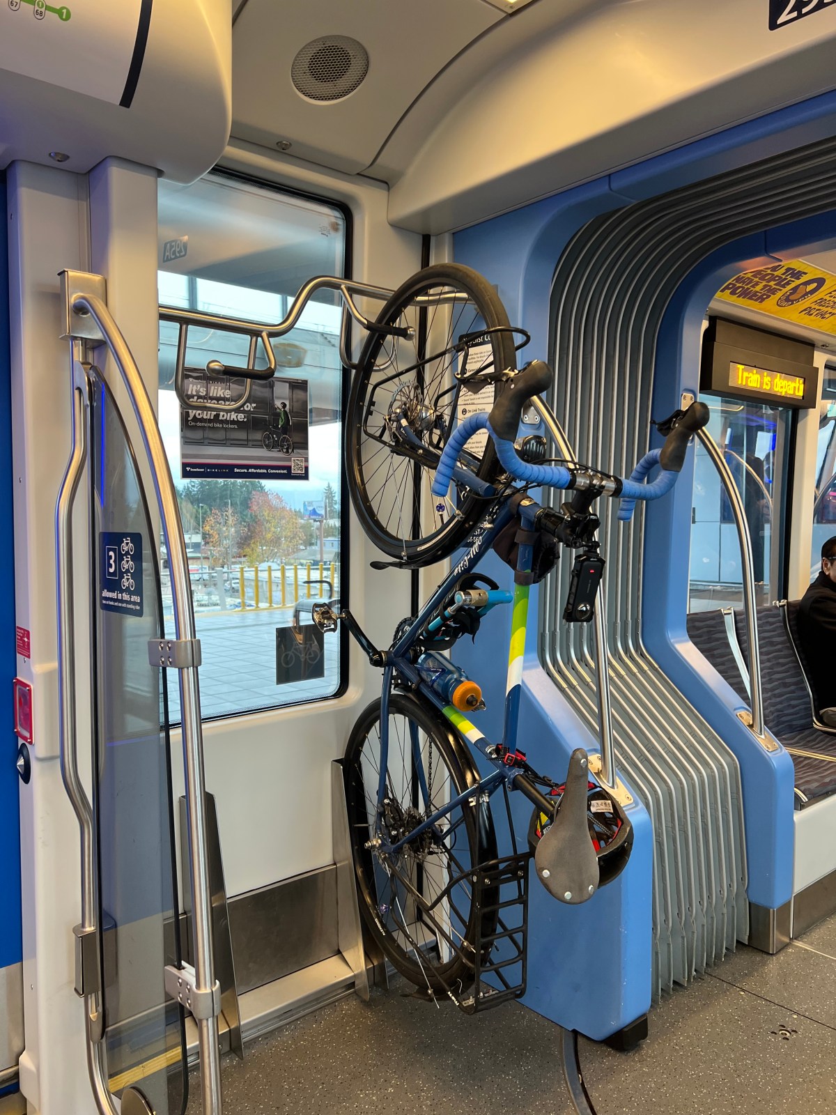
The vehicle fleet itself is familiar Link light rail equipment. Sound Transit’s Link fleet includes older Kinkisharyo Series 1 vehicles and newer Siemens Series 2 vehicles. When the first Series 2 cars entered passenger service, Sound Transit described them as Siemens-built vehicles joining the original Kinkisharyo fleet, with larger windows, more bike racks, wider center aisles, and updated passenger information systems. They are now part of the same general Link operating model: coupled light rail vehicles running as a trainset.
Each Link “car” is itself an articulated light rail vehicle with cabs at both ends, and trains are formed by coupling multiple vehicles together. Sound Transit documents from recent fleet and safety materials describe the Link fleet as a mix of Kinkisharyo Series 1 and Siemens Series 2 LRVs, designed to operate in multiple-car consists.
The train-length pattern is one of the more interesting operational differences right now.
The 1 Line has been associated with longer 4-car trains, especially through the busiest Seattle core and for major event loads. That makes sense. The 1 Line carries the airport spine, downtown Seattle, University of Washington, Northgate, Lynnwood, and now Federal Way. It has the mature demand profile and the big event surges.
The 2 Line across the lake is not running with that same constant 4-car feel. The operating pattern I have seen is more in the 2-car and 3-car range, which fits the current demand profile. This is a good example of Sound Transit matching capacity to actual load rather than simply maxing every platform slot because the system can theoretically support it.
That has tradeoffs.
Shorter trains mean lower operating capacity per trip, but they also mean the agency can keep frequency meaningful without hauling around excessive empty capacity all day. For a new cross-lake service still building travel habits, frequency is likely more important than maximum consist length at every hour. People need to trust that the train will be there often enough to stop checking the schedule like it is a ferry.
The 2 Line does not need to cosplay as peak-direction 1 Line event service all day. It needs to be reliable, frequent, legible, and comfortable enough that riders start changing default behavior.
Passenger Loads: Steady, Not Crushed (Thank Goodness!)
The passenger load is the part that feels most telling.
This is not an empty ceremonial train. People are using it. The ridership feels steady, real, and distributed across the line rather than concentrated only in one novelty segment. But it is also not packed in the way the 1 Line can get around stadium events, airport surges, or the UW-downtown crush.
That is not a failure. That is actually what you want to see early. It’s also something i’m really enjoying, considering I spent YEARS in Portland in crush capacity passenger counts on the MAX. That system is more expansive, but good God when it hits crush capacity and it is elbow to elbow only space – super annoying. That system had gotten to that points decades ago on the main trunk, and only after the pandemic wrecked ridership has it leveled back out some (albeit maybe leveled out too low). The Link trains on the other hand have leveled out at a pretty high ridership – but at 2, 3, and 4 car trains – hitting crush capacity is on the edges of some rush hours and game days, not every single day.
An overpacked new line is a capacity problem. An empty new line is a demand problem. A steady-but-not-crushed line is a habit-formation phase. Riders are testing it, commuting with it, using it for airport connections, cross-lake trips, downtown transfers, and the occasional “I just want to ride the new train across the bridge because obviously I do” (guilty as charged) trip.
The key metric will not be that opening-week enthusiasm, cuz it was packed then! It will be whether weekday usage settles into a durable pattern after the novelty fades and after bus restructures, employer commute patterns, university schedules, event traffic, and general regional behavior have had time to adapt.
Sound Transit has not yet published enough line-specific post-opening ridership detail to make grand claims about daily 2 Line volumes across the lake. So the honest read is observational: the trains are carrying people steadily, but the line has headroom. The system is not at crush capacity, and that gives the agency some operating flexibility while demand matures.
That is a good place to be for Seattle (and Bellevue, Redmond, and the other cities along the route!).
The Ride Quality and Passenger Experience
The ride itself is straightforward Link, which is mostly a positive.
Stations are legible. Transfers make sense if you already understand the Link pattern. The vehicles are familiar. The lake crossing is visually excellent without turning the trip into a tourist contraption. You are still on transit, not a theme ride, and that distinction matters.
The new stations at Mercer Island and Judkins Park are great practical additions. Mercer Island finally gets the rail station that has been argued about, designed, delayed, litigated in public discourse, and awaited for what feels like several geological eras. Judkins Park is the sleeper station in the set, because its value will grow as the surrounding bus, pedestrian, bike, and neighborhood access patterns mature.
The operational merge at International District/Chinatown is the piece to watch. Shared trunk frequency is useful, but reliability depends on maintaining schedule discipline where the two lines overlap. The more the system expands, the more Sound Transit has to behave like a mature rail operator rather than a project-delivery agency that happens to run trains.
What Works
The big win is obvious: the geography finally makes sense.
For decades, the region has had economic integration without transportation integration. Seattle, Bellevue, Redmond, the airport, the university district, and the northern and southern suburbs operate as one labor and cultural market, but the transportation network has forced too much of that movement through car traffic and highway buses.
The completed 2 Line changes that.
It does not solve every commute. It does not make Eastside land use magically dense. It does not eliminate the need for buses, bikes, sidewalks, park-and-rides, or better local connections. But it creates a rail option where one very obviously should have existed a long time ago.
The other win is the combined frequency through the core. More trains between Lynnwood and International District/Chinatown is not glamorous, but it is the practical improvement riders feel immediately. When a train is coming every few minutes, transit stops being an appointment and starts being infrastructure.
What I Would Watch
The first thing I would watch is reliability across the bridge and merge points. This is a technically unusual segment. It needs boring reliability over seasons, storms, heat, maintenance cycles, and peak service.
The second thing is train length. If 2-car and 3-car consists stay comfortable, great. If demand builds faster than expected, Sound Transit will need to add capacity without undermining reliability or starving the 1 Line fleet plan. The fleet has to serve the whole system, not just one photogenic crossing.
The third thing is bus integration. Rail lines do not reach their full value unless the local bus network feeds them well. The 2 Line can be excellent and still underperform if the last-mile and transfer patterns are clumsy.
The fourth thing is downtown transfer clarity. As the system adds lines and branches, passenger information has to get better. Occasional riders should not need a transit hobbyist friend to explain which train goes where or why things unfold during a routine trip in a certain way.
The Bottom Line
The Link crossing over Lake Washington is one of the more technically interesting transit openings in the United States, and it mostly behaves exactly how it should: like normal transit.
The infrastructure is unusual. The ride is ordinary. The trains show up. People board. The lake slides by. Bellevue, Mercer Island, Judkins Park, downtown Seattle, and Lynnwood become part of a single rail trip.
The 2-car and 3-car trains feel appropriate for current demand, especially while the line builds its regular ridership base. The 1 Line still carries the heavier 4-car identity through the busiest trunk and event-heavy portions of the system. The passenger counts, at least from observed loads so far, feel steady but not overloaded.
That gives the 2 Line room to mature.
And that is the real story. This is not just a new ride. It is the moment the regional rail map starts behaving like a regional rail map.
It’s about damn time too. Seattle has only been waiting for about 80 years to have rail service to the east side again. (IYKYK)