Light Rail!

Every Bus, Train, and Ferry in Puget Sound — On One Live Map

Every bus. Every train. Every ferry. Right now, moving, on one map.

Not a schedule. Not a “planned frequency” PDF. Not a rendering in some agency slide deck. The actual vehicles, where they actually are, this actual minute.

I found it at dashingarrivals.com, and I’ve lost an embarrassing number of minutes to it since. It’s a live map of the whole Puget Sound transit system — King County Metro, Sound Transit, Community Transit, Pierce, Kitsap, Everett, and the Washington State Ferries — all of it, all at once. On a weekday afternoon that’s north of 1,100 vehicles breathing across the screen. And yes, I’ve been sleuthing it. That’s the whole point of this blog, isn’t it.

The Whole Region, Live
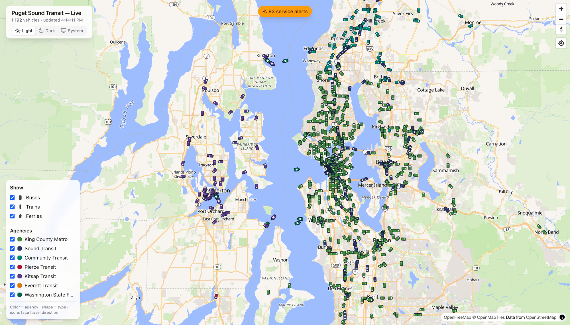
Here’s the thing that got me. Open it up and the region just… resolves. Green dots pour down the I-5 spine. Teal Community Transit coaches fan out across Snohomish County. Purple Kitsap buses cluster around Bremerton, and the ferries — the ferries — leave little wakes across the middle of the Sound like they’ve got somewhere to be. Which they do.

The legend is honest and simple: color is the agency, shape is the mode, and every icon points the way it’s traveling. That’s it. No account, no app store, no dark patterns. You just watch the region move.

Click a Boat, Meet the Tacoma
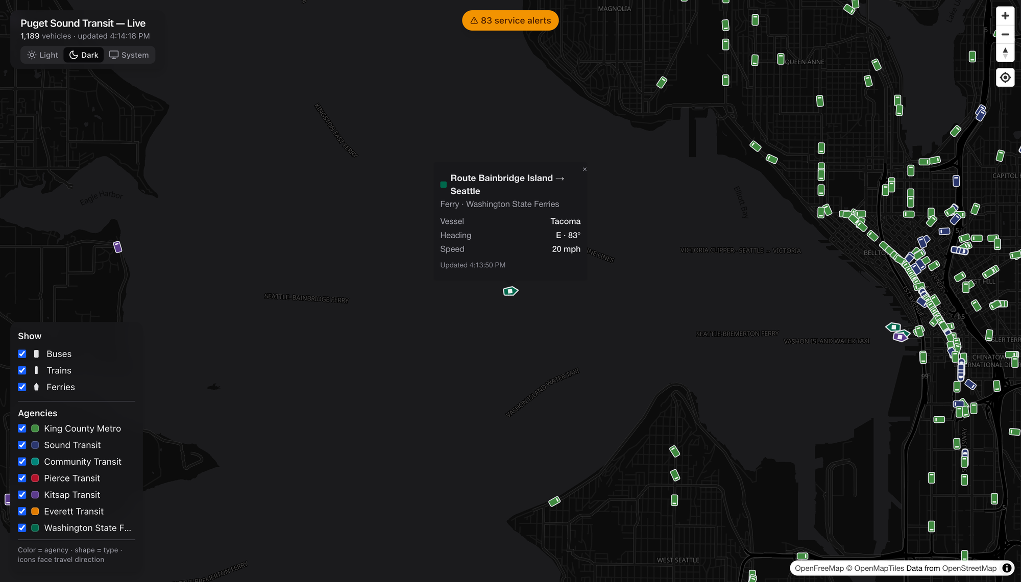
Tap any vehicle and it introduces itself. I clicked a green diamond mid-crossing and got the Tacoma — a Washington State Ferry, Bainbridge Island → Seattle, heading east at 20 knots. A named boat. I did not need that detail to live my life. I loved having it anyway.

Buses give you the coach number, trains give you the car, and everybody gives you heading, speed, and the last time they phoned home. It’s the kind of granularity that turns a map into a rabbit hole.

Show Me the Route

Every popup has a Show route link, and this is where I stopped being casual about it. Click it and the map draws that vehicle’s entire line — the shape and every stop — under the live vehicles still running it.
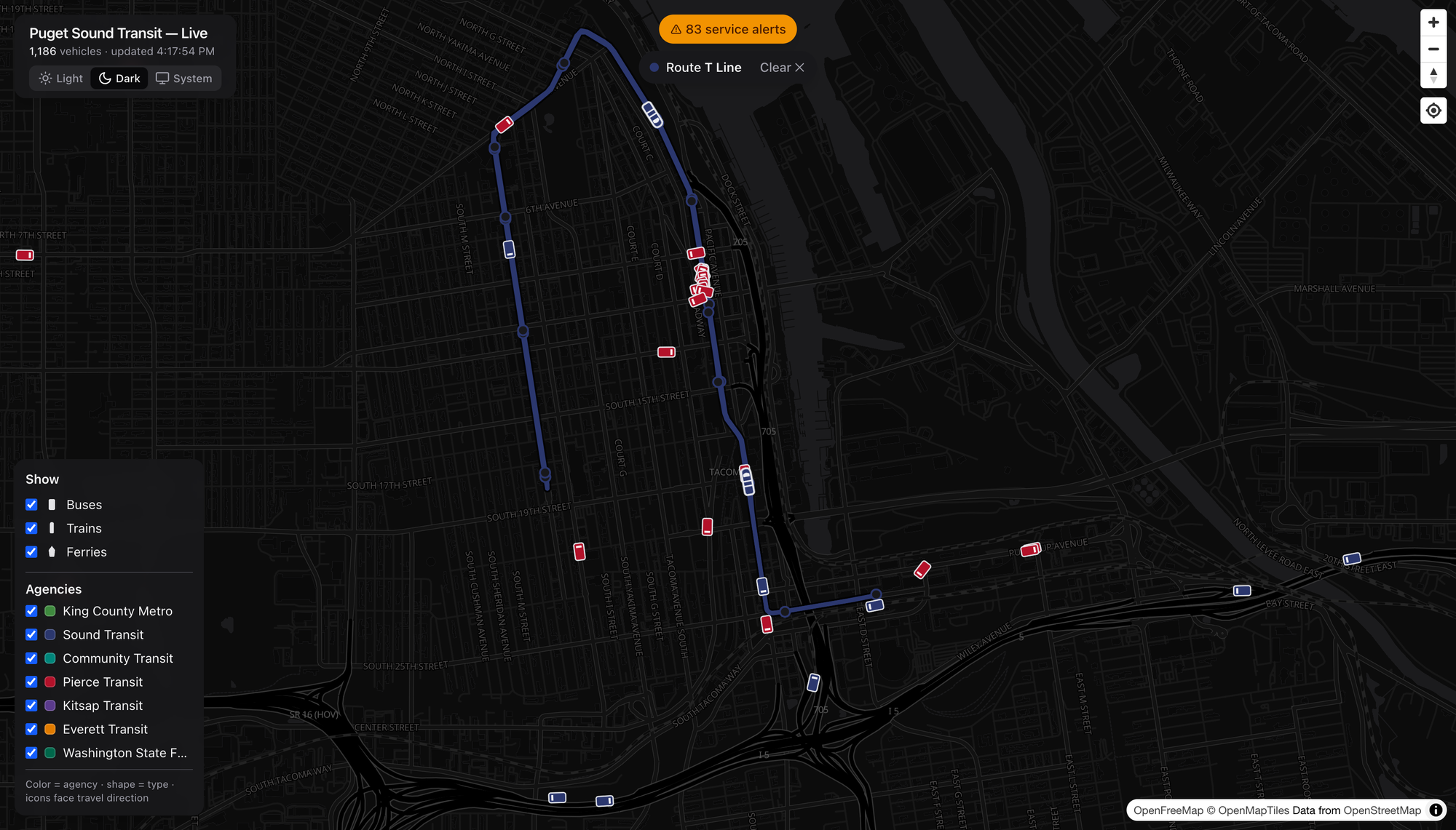
Watch the little T Line streetcar trace its loop through downtown Tacoma, red Pierce Transit coaches swarming around it. It’s a small system. It’s also real, and it’s on the map with everything else.

Rail That Isn’t Just Link

Here’s a public service announcement: the Puget Sound has more rail than most people riding it realize. Sounder is the one folks forget.
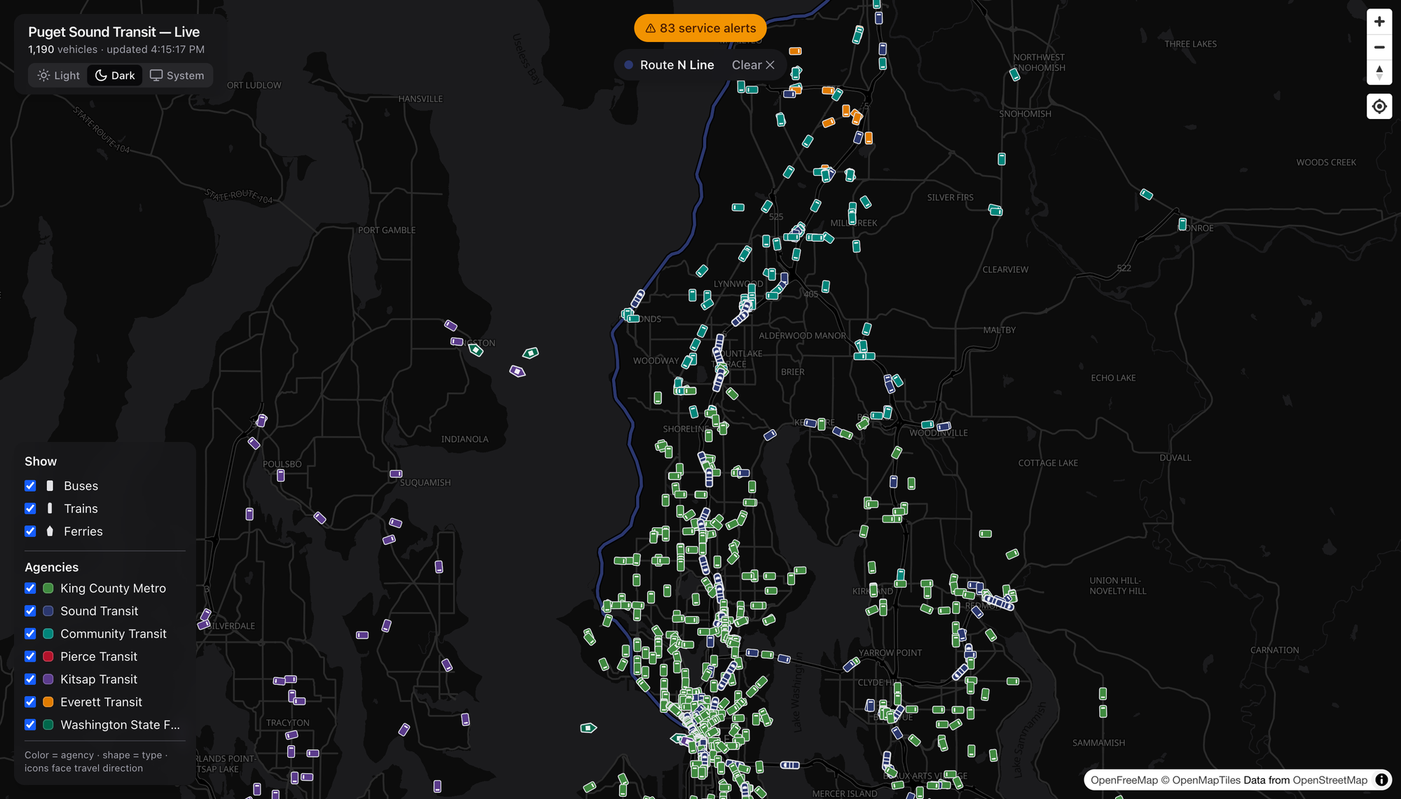
This is the N Line — Sounder commuter rail, Everett down to Seattle, hugging the water past Mukilteo and Edmonds. It only runs at the peaks, so catching a train on the map is a little reward for looking at the right hour. Pull the route up and the whole coastal alignment lights up, with Community Transit teal and Everett Transit orange filling in the last-mile around it. That’s a network — commuter rail doing the trunk, buses doing the capillaries.

Buses Get the Same Treatment

The route trick works for anything with wheels, which means you can finally see what a line actually does.
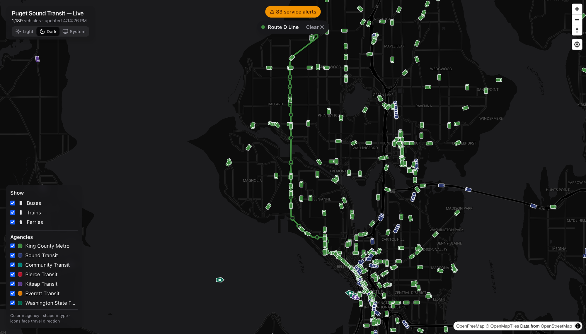
The RapidRide D Line in Metro green — Crown Hill and Ballard down through Interbay into downtown.
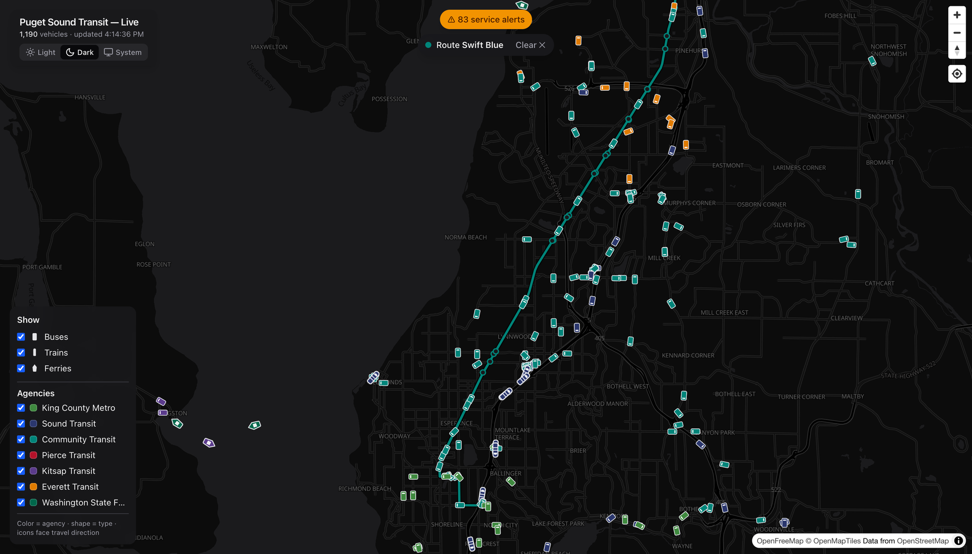
Community Transit’s Swift Blue in teal, running BRT straight down the old Highway 99 corridor from Everett to Shoreline — the kind of frequent, legible, get-on-and-go line I wish we built ten more of.
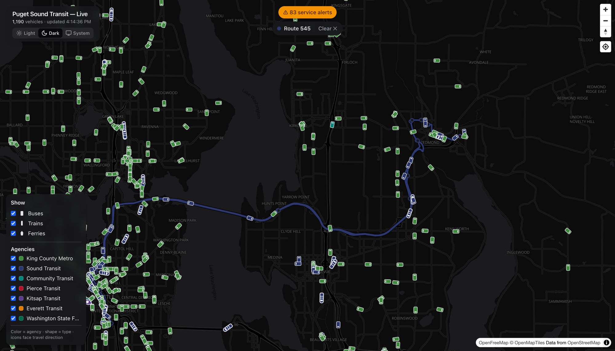
And the ST Express 545 in Sound Transit blue, humming across the 520 bridge to Redmond. Lettered RapidRide, numbered local, Swift, ST Express — pick any of them and the corridor lights up the same clean way.

Filter Down to One Agency

Eleven-hundred vehicles is a glorious mess. So dial it in.
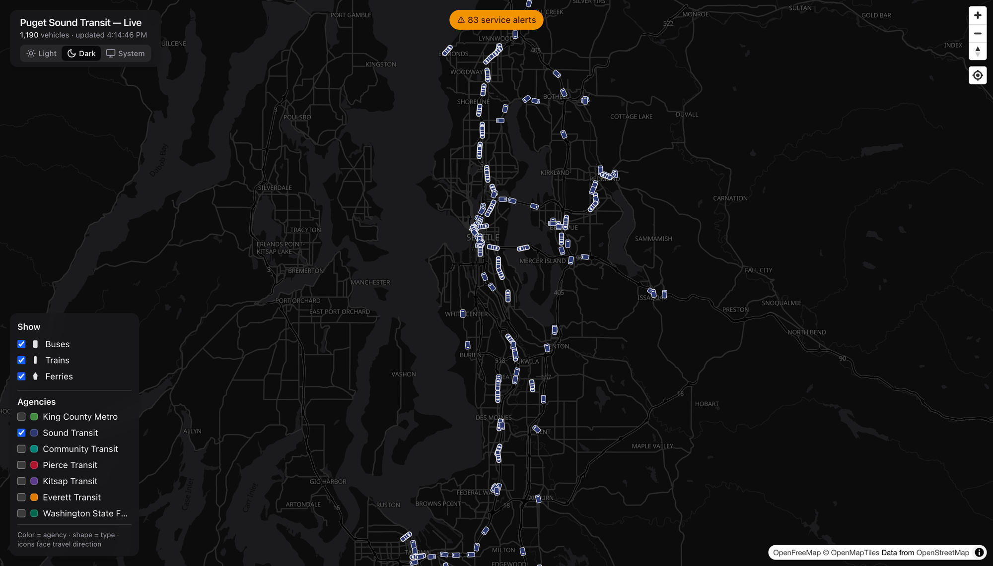
I unchecked every agency but Sound Transit, and there it is — the ST spider laid bare. Link threading north–south and across the lake, Sounder on the corridors, the T Line way down in Tacoma, ST Express filling the gaps to Redmond and Issaquah. One toggle and you’ve got the regional operator’s entire footprint, nobody else’s. Do the same with the modes and you can strip it down to just the boats if you want. (I want.)

When’s the Damn Bus
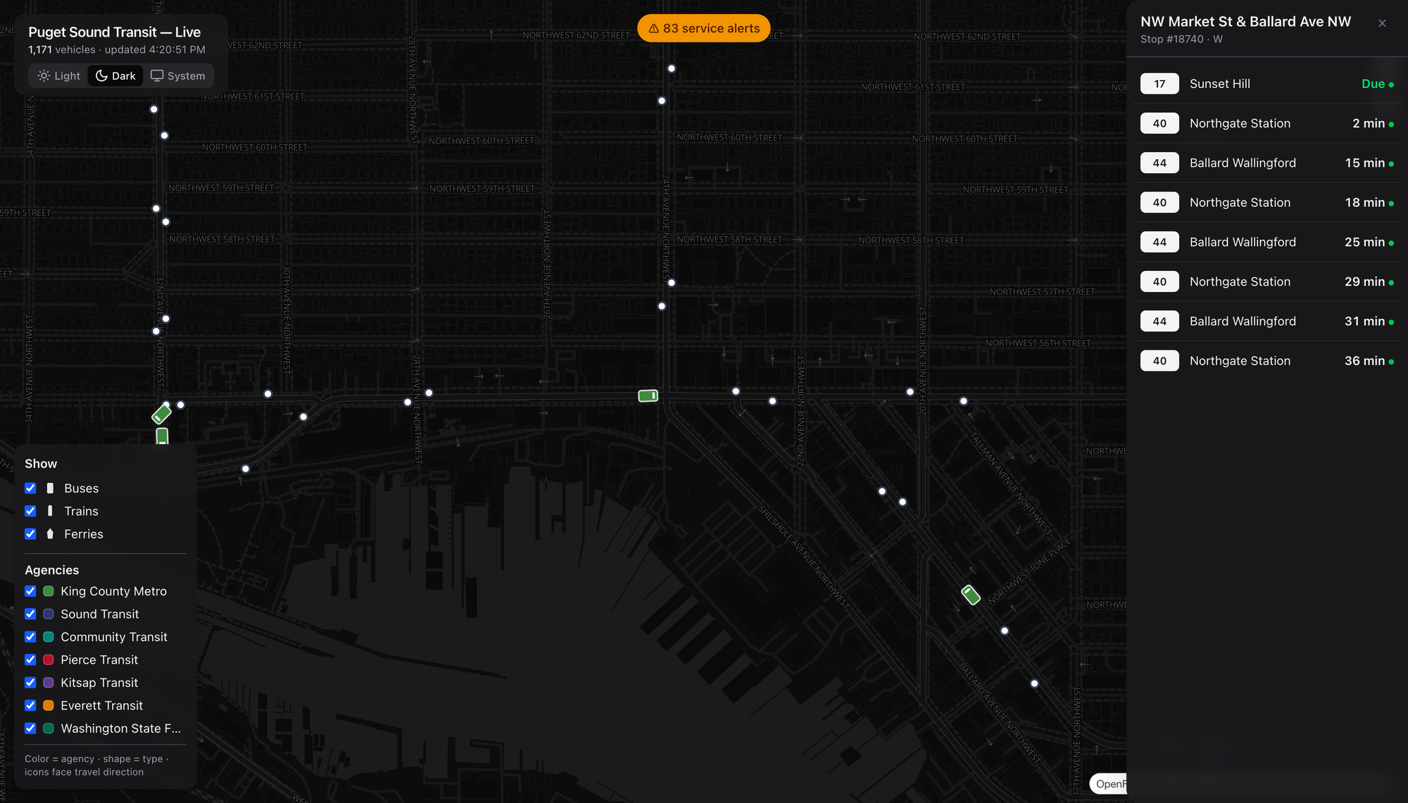
Zoom in and the stops appear. Click one — I grabbed NW Market & Ballard Ave — and you get a live arrivals board: the 17 to Sunset Hill due, a 40 to Northgate in two minutes, the 44 behind it. Real predictions with real countdowns, the same numbers you’d squint at on the sign, except you’re looking three blocks ahead before you leave the house. This is the part that’s actually useful, not just fun.

The Disruption Board
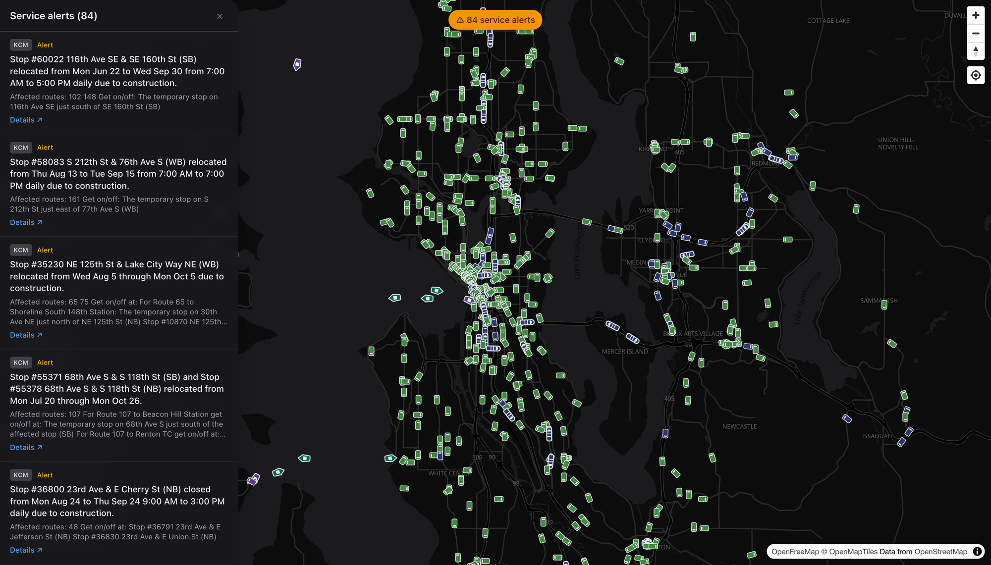
There’s a running count of active service alerts up top — reroutes, stop closures, construction, the usual regional churn — and opening it gives you every one, with the agency, the affected routes, and where to actually catch your bus in the meantime. It’s the “what’s broken right now” board for the whole Sound in a single scroll. Boring? Sure. Boring is exactly what you want from transit information.

Dark or Light, Reader’s Choice
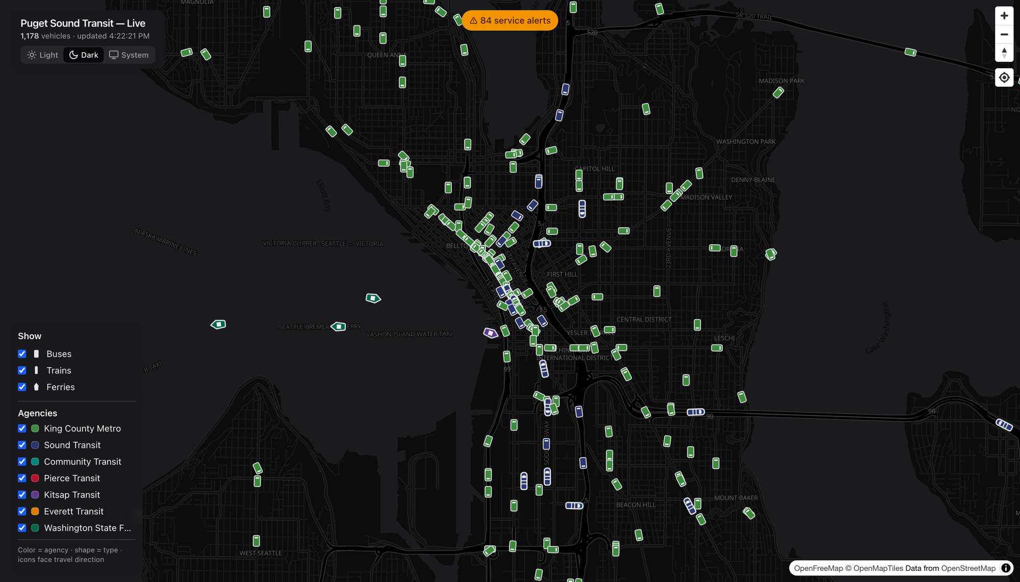
There’s a theme toggle — a crisp dark basemap for the night owls and vehicle-watchers, a bright one for daylight planning, and a System setting if you’d rather it just follow your machine. Same live data, different mood. I keep it dark. Obviously.

What I’d Watch

A few honest notes, because I can’t help myself:

  • Coverage is only as good as the feeds. This rides on the region’s OneBusAway data (plus WSDOT for the boats), so if an agency’s real-time feed hiccups, the map hiccups with it. Not the map’s fault — but it’s the ceiling.
  • Sounder and the T Line are peak-and-place dependent. Show up off-peak and the commuter rail is simply gone from the screen. That’s the schedule, not a bug, but a first-timer might not know to look at 5pm on a Tuesday.
  • This is a watcher’s tool that happens to be a rider’s tool. The arrivals and alerts make it genuinely practical, but the joy is in the whole-region view — and joy is a perfectly good reason for a thing to exist.

The Bottom Line

We spend a lot of energy in this country pretending transit is invisible — burying it under the regional asphalt car-sewer ritual until nobody can picture the network even existing. A map like this does the opposite. It makes the system legible. You can see, at a glance, that the Puget Sound already moves an enormous number of people by rail, bus, and boat every single minute of the day.

Go look. Click a ferry. Show a route. Find a stop near you and watch the next three buses roll toward it. Then go ride one — the best discoveries are always at the other end of a line you hadn’t tried yet.

Enjoy your day dear readers, cheers! 🚈

dashingarrivals.com


Screenshots grabbed live from dashingarrivals.com. Basemap © OpenFreeMap / OpenMapTiles, data © OpenStreetMap contributors. Real-time feeds via OneBusAway and WSDOT.
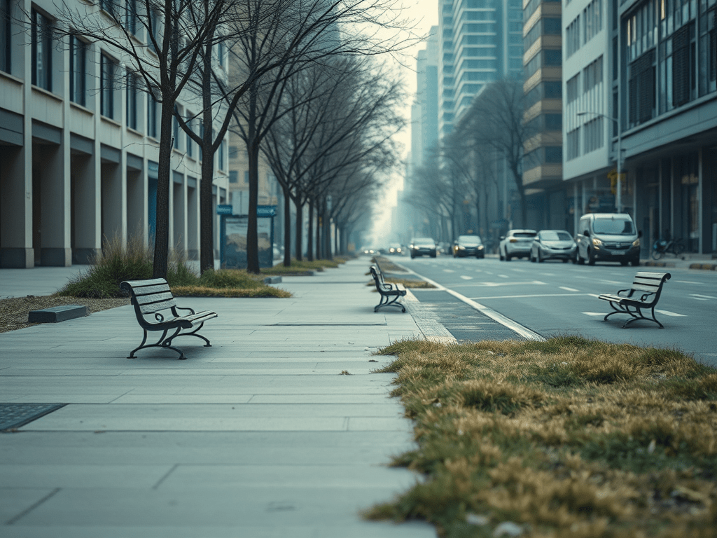
Part 2: Pavement and Isolation – How the Car Killed Community

Welcome to Part 2 of this series where I continue unpacking how the U.S. systematically dismantled social connection in the name of “progress.” Last time, I wrote about how third places are disappearing. This time, I’m dragging the main culprit into the light: the car.

Yeah. That big metal box in your driveway? It’s not just polluting the air and draining your wallet—it’s actively devouring public space and community life.

How Cars Obliterated Third Places

Let’s be clear: the problem isn’t cars exist. The problem is how everything else was restructured around them, leaving zero room for anything human-scale. Starting in the mid-20th century, we redesigned American life for traffic flow, not people.

Here’s what that did:

  • Neighborhoods got zoned into silos—residential over here, retail over there, work way over there.
  • Public plazas, local markets, and informal hangout zones got paved over for parking lots.
  • Sidewalks were shrunk, ignored, or removed entirely. Because who walks anymore, right?
  • New “town centers” became drive-to destinations with no soul and no real public use space.

This made third places—those informal community spaces—impractical, unprofitable, and in many places, literally illegal to build.

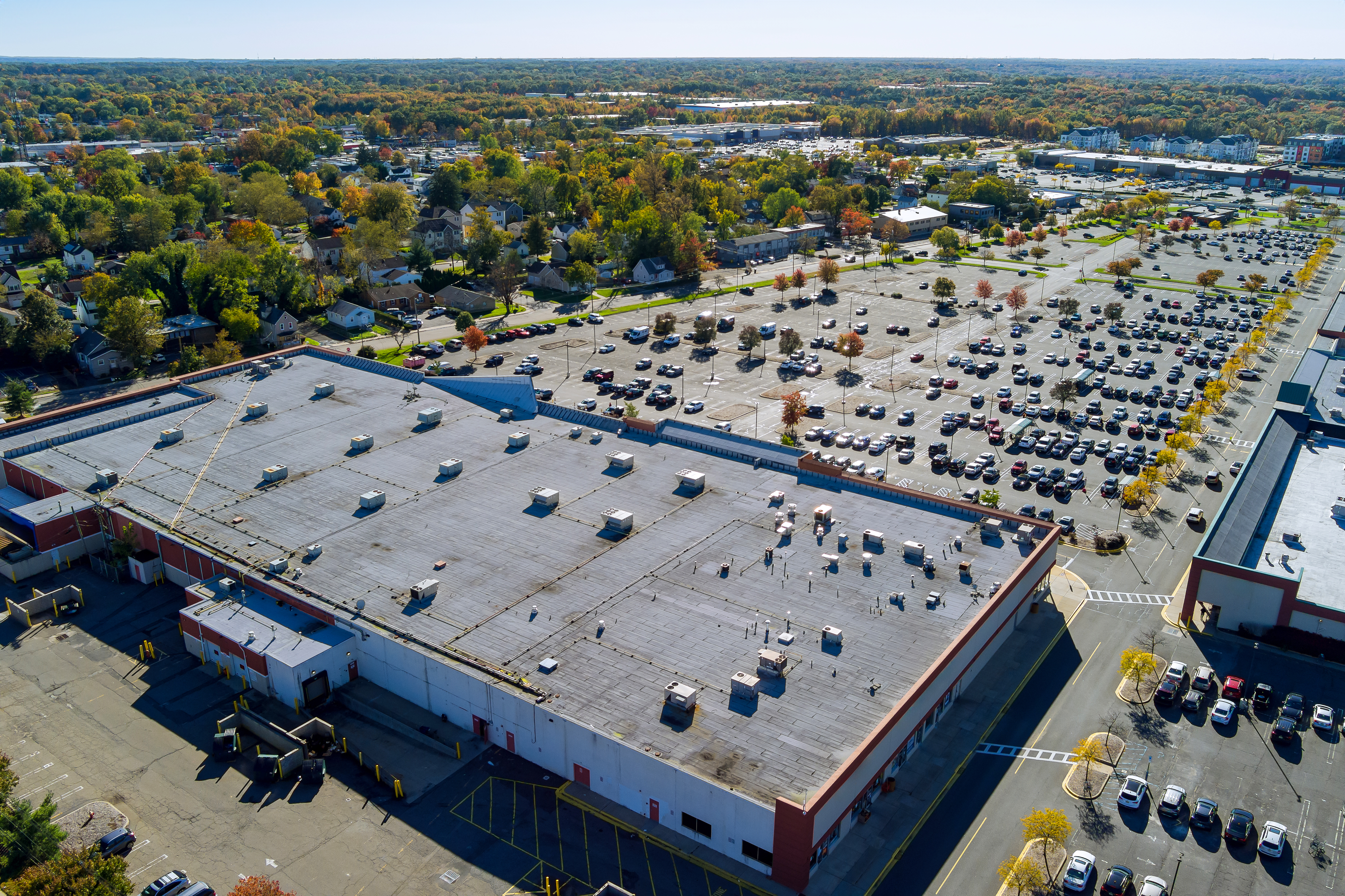
Big parking with cars near the shopping mall center in New Jersey USA

Parklets: A Glimmer of Hope (That Mostly Got Crushed)

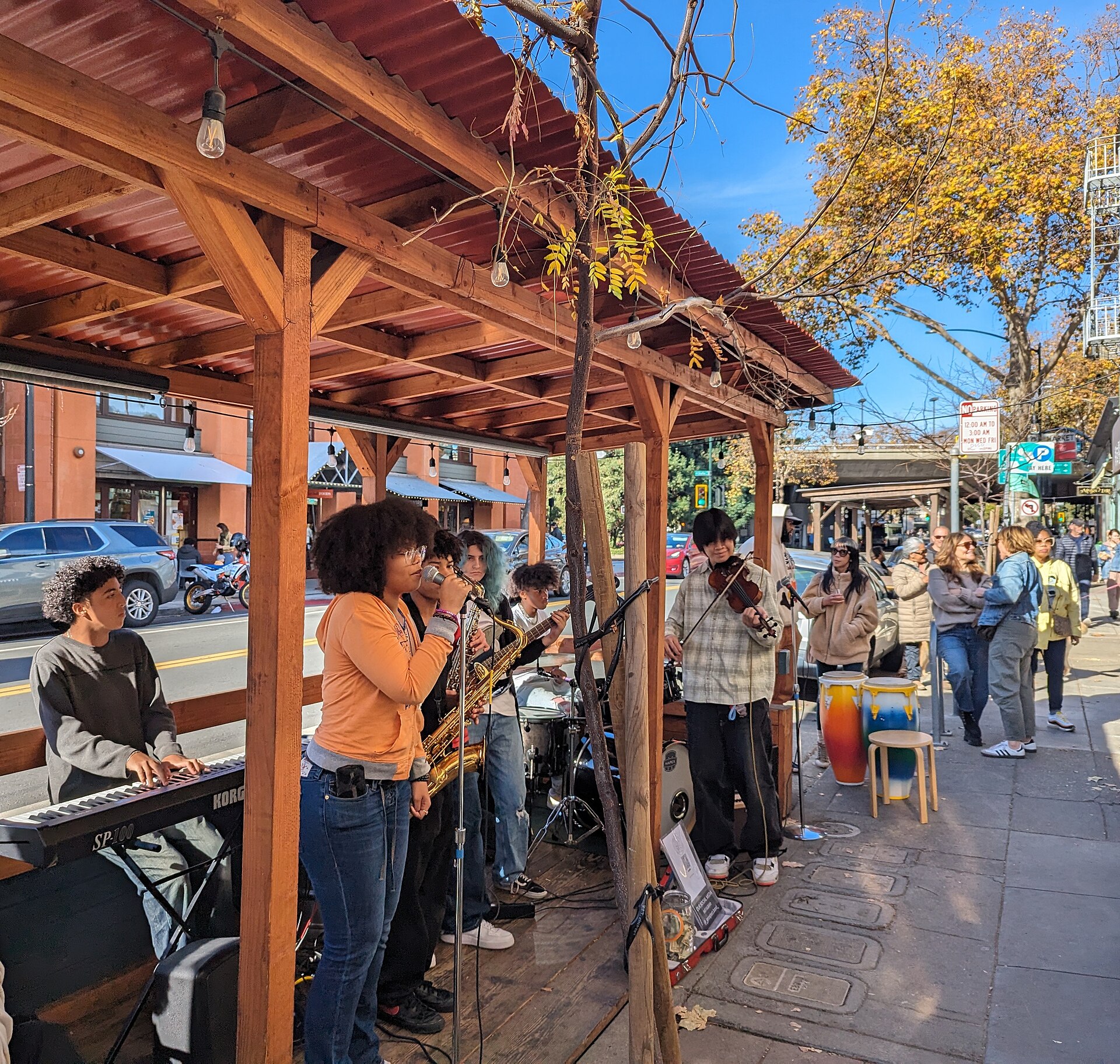
In the early 2010s—and then again during the pandemic—we saw something weird: parklets started popping up. Cities let restaurants and businesses convert curbside parking into mini patios and gathering spaces. They were scrappy, hopeful, often built with plywood and planters.

And for a moment? They worked.

People lingered. They talked to strangers. They treated streets like places to be, not just pass through.

Then the tide turned:

  • Restaurant leases ended, and the parklets vanished.
  • Cities caved to complaints from drivers about “lost” parking.
  • Insurance policies and red tape choked the small businesses trying to keep them alive.

And just like that, most parklets faded back into asphalt.

Part 1: Disconnected by Design – The Death of the Third Place

> “A third place is a space that isn’t home (the first place) or work (the second place). It’s where people go to just exist together.”
> — Ray Oldenburg (Paraphrased and adapted for modern reality)

Let’s get something straight up front. Third places are disappearing (or already disappeared) in America. And no, we’re not talking about some twee idea of a cafe with succulents and overpriced drip coffee. We’re talking about foundational infrastructure—the places that once held the social fabric together.

We’ve designed them out of our neighborhoods, priced them out of our cities, and paved over them in the name of “development.” What’s replaced them? Nothing of substance. Just parking lots, chain retail, and algorithmic dopamine feeds that masquerade as community.


What Is a Third Place (And Why It Matters)

A third place is simple in concept: a social setting where people gather that isn’t home or work. Think:

  • Libraries (Please stop closing them, just figure out how to make em’ work, because they will!)
  • Coffee shops (actual community hubs, not Starbucks outlets)
  • Bookstores with comfy chairs
  • Park benches with regulars
  • Local bars, barber shops, bike co-ops
  • Public plazas, community centers, corner bodegas where people linger

These places foster unplanned conversation, spontaneous collaboration, and yes—real, human connection. They offer a counterbalance to the transactional nature of modern life.

And in the U.S.? We’ve systematically eliminated them.

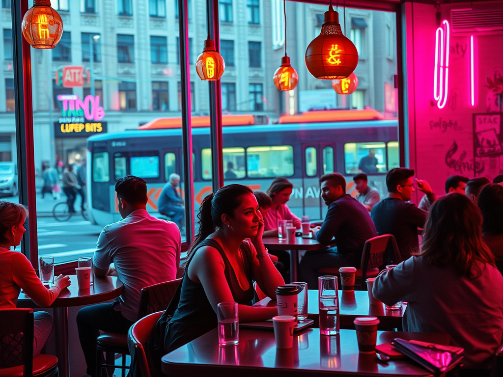
Business freelance team chatting during coffee break in office. Creative multiethnic colleagues engaged in teamwork at coworking open space

From Common Ground to Commercialized Nowhere

If you’re in a suburb, odds are your nearest third place is at least a 10-minute drive away—and no, a drive-thru Starbucks doesn’t count.

Urban planning over the last 50 years has systematically pushed out the informal, low-cost, and unbranded spaces in favor of traffic flow, parking capacity, and revenue-per-square-foot. The result?

  • Communities where there is no place to gather without spending money
  • Spaces that feel sterile, overly regulated, or outright exclusionary
  • Entire generations growing up with no idea what a third place even is
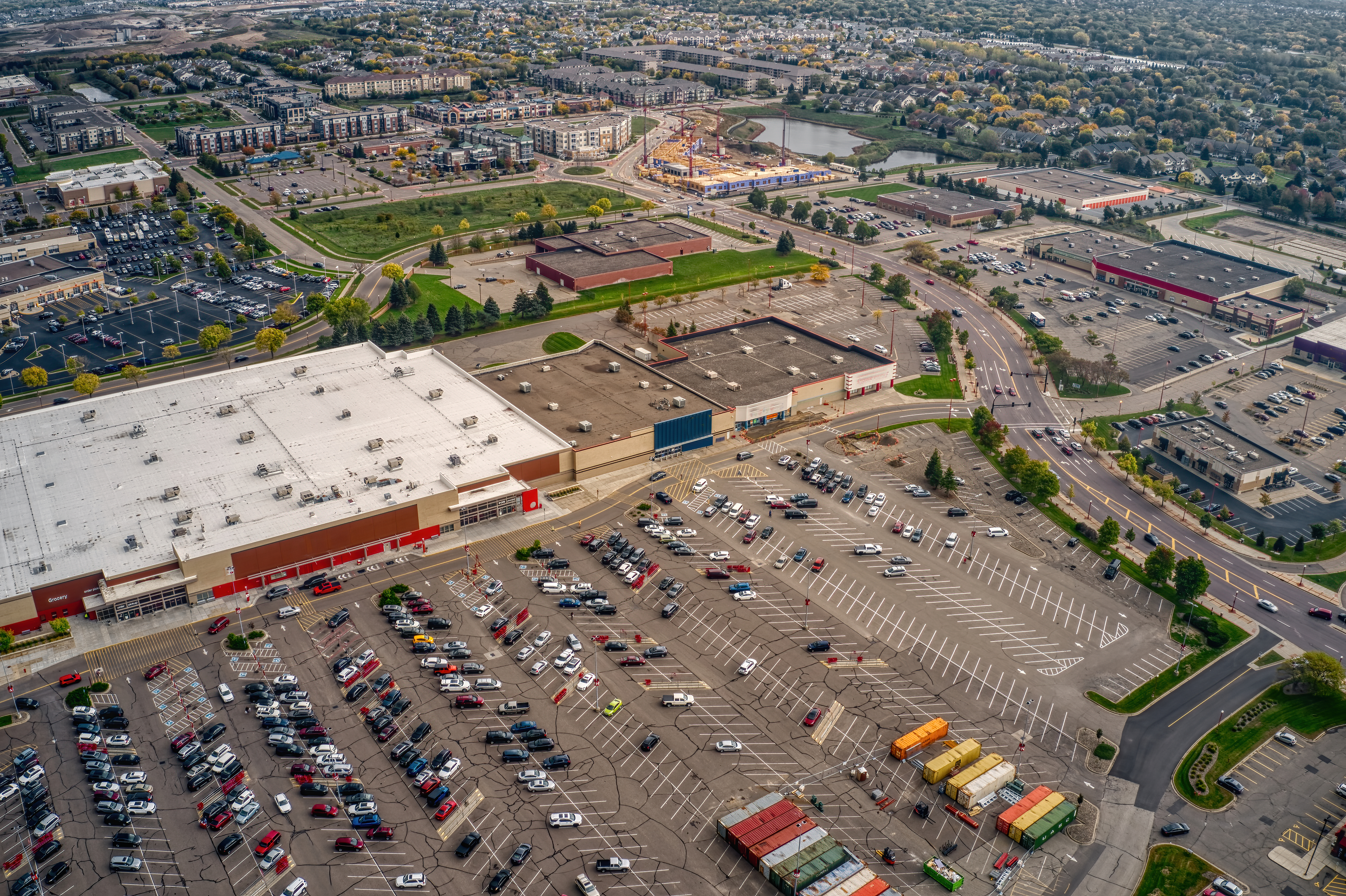
An aerial view of the Twin Cities Outer Suburb of Apple Valley, Minnesota

The Great Digital Substitution (That Isn’t)

Somewhere along the way, we convinced ourselves that social media was a good enough replacement. That Discord servers could be the new pub. That Reddit threads replaced roundtables. That Instagram comment sections were valid forms of shared experience.

No.

Those are digital holding pens designed to manipulate your attention, not give you context, warmth, or presence. You can’t replace a knowing glance or a random conversation with a stream of hot takes and emojis.

They mimic connection. But they don’t create it.

Case Study: Third Place Commons – Holding the Line

Located in Lake Forest Park, Washington, Third Place Commons is one of the few community anchors that still embodies what a third place should be.

  • It’s open to everyone.
  • It hosts events like chess nights, concerts, and civic forums.
  • It’s tied into a bookstore (shoutout to Third Place Books).
  • It isn’t flashy, and that’s the point.

When You Erase the Third Place…

…you erase empathy. You erase frictionless socializing. You erase the chance to bump into people outside of work and curated social events. You erase the “Hey, good to see you again” rhythm that holds communities together.

You replace it with:

  • Loneliness
  • Economic stagnation
  • Fragmented civic life
  • Performative connection

And then we act shocked when people are burnt out, disconnected, and angry.

Next Up: The Car That Ate Your Community

In Part 2, I’ll get into how the automobile didn’t just kill walkability—it nuked third places out of existence. We’ll talk about the rise and quiet death of parklets, the shrinking of civic spaces, and how cities like Portland tried (and often failed) to fight the tide with bike co-ops and transit stations.

If this series hits a nerve, good. It’s supposed to.

You can’t rebuild what you don’t even realize is missing.

The Chaos & Madness of Forgetting One’s Keys

I have a rather interesting commute these days. It consists of four parts for the time being.

  1. Departure from home and arrival at the Redmond Link Station via e-bike.
  2. Departure with Spacey (this bike) from the Redmond Link Station to South Bellevue Station.
  3. Departure from South Bellevue Station via the Sound Transit Express 550 bus.
  4. Then via bicycle to the little coffee shop (i.e. Starbucks HQ) in Seattle’s SODO.

Today I departed from home and traversed all of the parts of my commute until arrival at South Bellevue Station. I then realized I had forgotten my keys at home. The keys I use to lock my bike via u-lock at the coffee shop. No keys no lock, so that wouldn’t do.

So a good 1/2rds of the way into the city I made the u-turn to head back to get my u-lock keys. Back to the Redmond Link Station, I parked Spacey, and then took the e-bike back up the hill to home. I got my keys and headed back out again.

An Aside: Naming Chaos Among Key Chaos

Alright, let’s detail this topic for a moment. What the hell is wrong with Seattle and naming things. Before Redmond Technology Station became “Redmond Technology Center”, it was called Overlake Transit Center. They renamed it and the next station, which is still just touching Microsoft Campus, is called Overlake Village Station. No confusion to be had for anybody that has been in the area for more than a few years, no none at all.

Amidst that ridiculousness Marymoor Park Station is only tangentially connected to Marymoor Park. To get anywhere where people congregate in the park you’ve got to walk between 3-20 minutes to get there. Then there is the Symphony Station, once the University Station but not connected to the University District and confusing to folks about what University, if any, it connected to. Because the nearest was many blocks away. But I digress.

I could go on and on about this and the locations, because it is clear there were powers that worked diligently against the light rail to make it less than useful. However in spite of these assholes and short-sighted fools, it’s already immensely useful even with the stop locations.

Back to Key Chaos

Now that I had back tracked to get my keys, I was at least an hour behind my expected arrival at the office. In addition, a meeting was coming up that I wouldn’t make unless I only traversed part of my trip and stopped to have the meeting. I had done this before, where I would go part of the way, then stop at a coffee shop or somewhere that wifi exists to attend a meeting. Then I would continue onward.

Today I decided to stop at the Dote Coffee Shop at Redmond Technology Station. It seemed like a perfect, down to the minute, timing to get part of the way into the commute and also attend the meeting.

A Note on Dote @ Redmond Technology Station

The Dote located at the Redmond Technology Station (here) is a pretty cool location. It is however kind of a stand alone very transit station specific location. All of the other amenities that Softies (That’s what Microsoft employees are called, I kid you not) enjoy such as their walkable urban area is up the street a few blocks and not entirely evident – or that accessible without a little mischievousness or having a blue or orange badge. So this is the publicly accessible option in the area, and it’s pretty great.

However, even though it is a private business not particular part of Microsoft, this location is forced to use the Microsoft wifi. This has always been a bit of an odd logistical lift for Microsoft. The reason being is that Microsoft treats all of the businesses and amenities in the area – even when they are on public property and owned by the local city and public – as if it is their own owned amenities. It’s a weird relationship to say the least.

Amidst all that, I managed to arrive at the station in time to get into the shop in time for the meeting and a drink.

The Last Leg, Broken

Finally, my meetings wrapped up and I began the last leg to get into the office. I walked out of the store, unlocked my bike and progressed toward the Link tracks to board a south bound train. I arrived, saw a train sitting there and noticed it wasn’t moving. After a minute or so I gave up and headed over to the south bound 40th St stop to board – hopefully – the Sound Transit Express 542.

I opted for the 542 (direct to University District) instead of the 545 (the more direct shot into the city) because I could ride it for a short haul into U-District and then board the Link Light Rail through downtown to SODO. They key difference here is I could work on the Link vs. not so easy on the bumpy buses.

I locked out and as I rode my bike up over the highway pedestrian and bike bridge to the other side to board the south bound buses, I only had 4 minutes until the 542 arrived. It pulled in, I racked my bike, and off we went. Upon arriving at U-District I took the elevator down and onto the 1-Line Link Train south through the city. I was able to rack my bike and get a seat, working through the remainder of the trip.

So that was my rather chaotic commute today, one for the books of misadventures in getting the logistics wrong over forgotten keys. Until next trip, cheers!

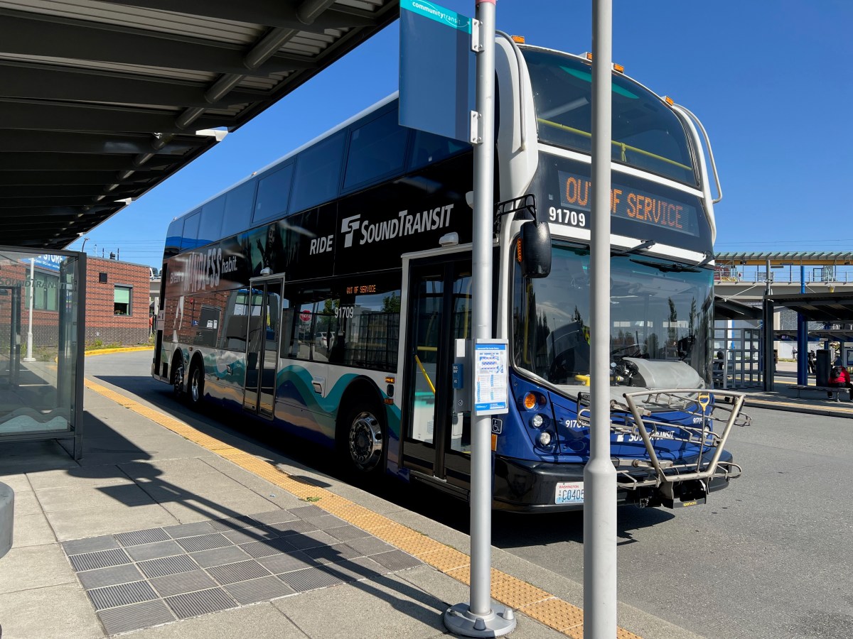
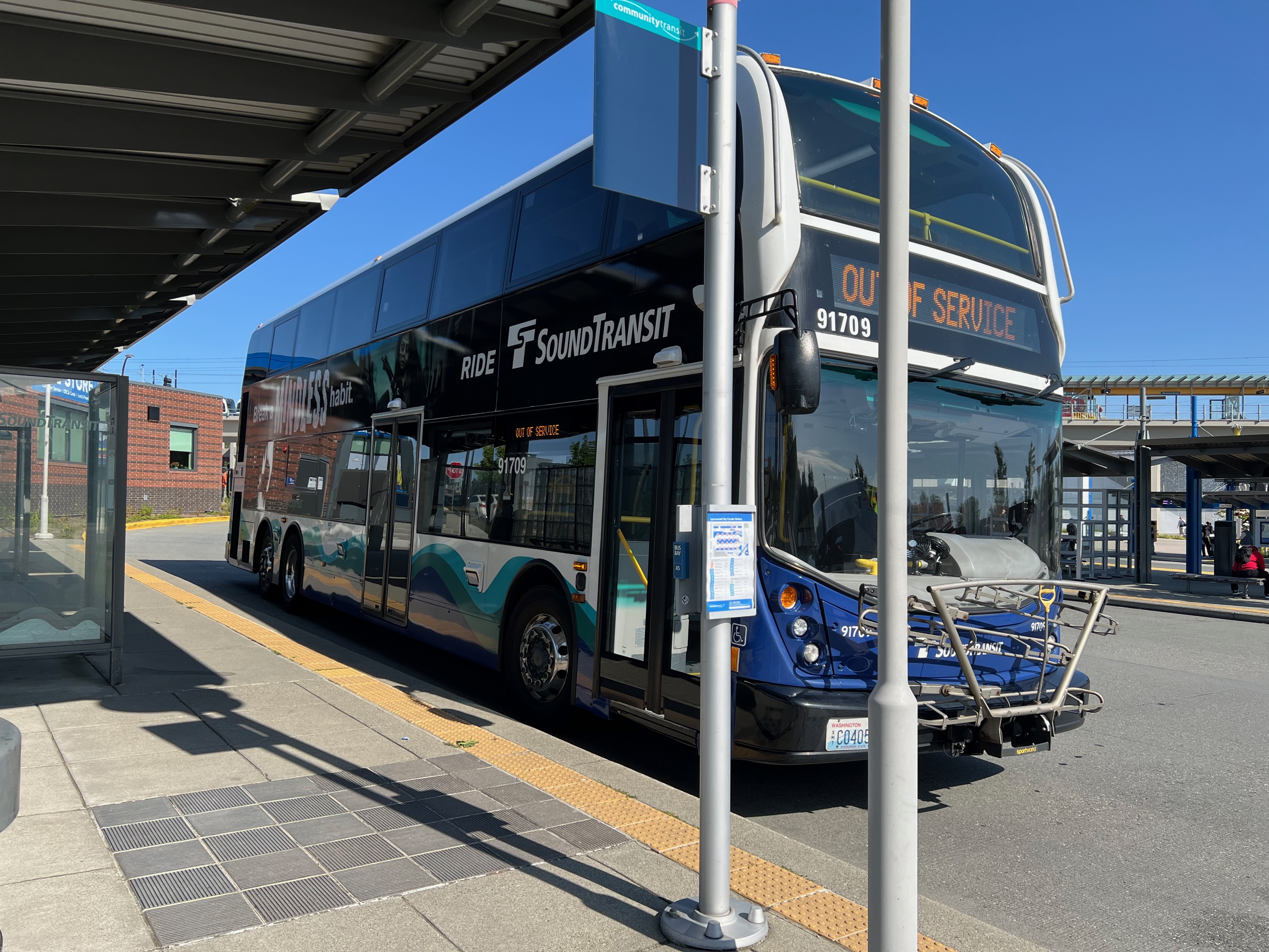
Sound Transit Double Tall

Seattle Explorations & A Guide to Double Talls

First a bit about double tall busses. Then a bit about my trip out to Lynnwood to finally, after years of wanting to ride a double tall, doing so!

Double tall buses, also known as double-decker buses, have become an iconic part of Seattle’s public transportation landscape. These impressive vehicles offer increased passenger capacity while maintaining a smaller footprint on the road, making them an efficient solution for high-capacity routes.

The Alexander Dennis Connection

The majority of double-decker buses in the Seattle area are manufactured by Alexander Dennis Limited (ADL), a British bus manufacturer with a strong presence in North America. The company’s Enviro500 model has become the standard for double-decker operations in the region.

Sound Transit’s Fleet

Sound Transit operates a fleet of Alexander Dennis Enviro500 buses, specifically the MMC (Multi-Modal Coach) variant. These buses feature:

  • Length: 45 feet
  • Height: 14 feet
  • Capacity: 81 passengers (57 seated, 24 standing)
  • Engine: Cummins ISL9
  • Transmission: Allison B500R
  • Air conditioning and heating systems
  • Low-floor design for improved accessibility
  • USB charging ports and WiFi

The Enviro500 MMC is known for its modern design, fuel efficiency, and passenger comfort. Sound Transit primarily uses these buses on their ST Express routes, particularly on high-demand corridors like the 510/511/512 routes between Seattle and Everett.

Other Operators

While Sound Transit is the primary operator of double-decker buses in the region, other transit agencies have also incorporated them into their fleets:

  • Community Transit: Operates Enviro500 buses on their Swift Bus Rapid Transit lines
  • King County Metro: Has tested double-decker buses on certain routes

Technical Specifications

The Alexander Dennis Enviro500 MMC features several advanced technologies:

  • LED lighting throughout
  • Electronic destination signs
  • GPS tracking and real-time passenger information
  • Advanced driver assistance systems
  • Euro 6 compliant engines
  • Composite body construction for reduced weight

Impact on Seattle Transit

The introduction of double-decker buses has significantly improved capacity on key routes, particularly during peak hours. Their ability to carry more passengers while taking up the same road space as a standard bus has made them an efficient solution for Seattle’s growing transit needs.

Taking a Ride to Lynnwood

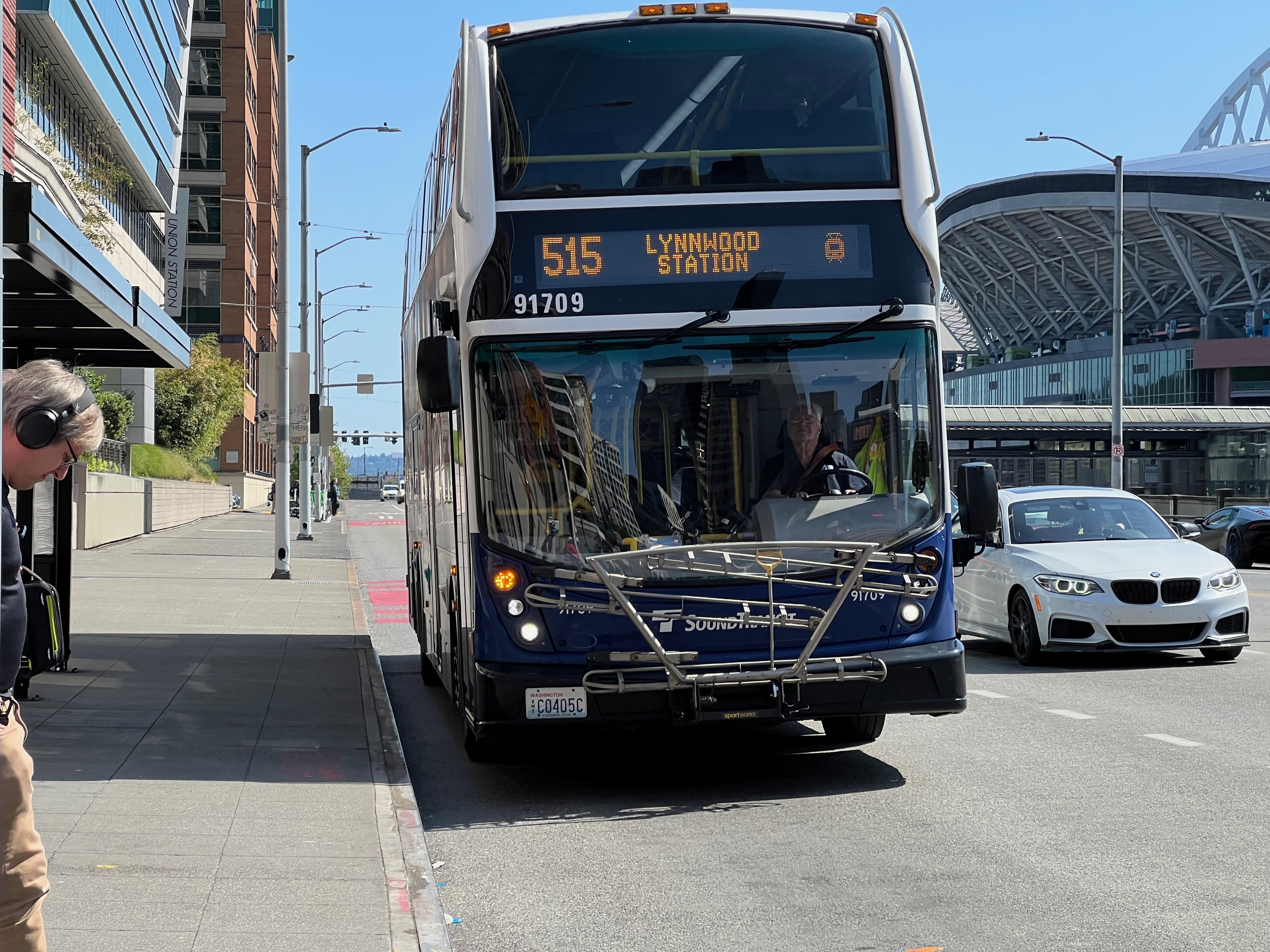
Today I took a ride, for the very first time, on one of Sound Transit’s double decker buses. I opted, since it would include some light rail usage, to take the 515 Express from downtown Seattle to Lynnwood. This is the story, of all the things I noticed along the way.

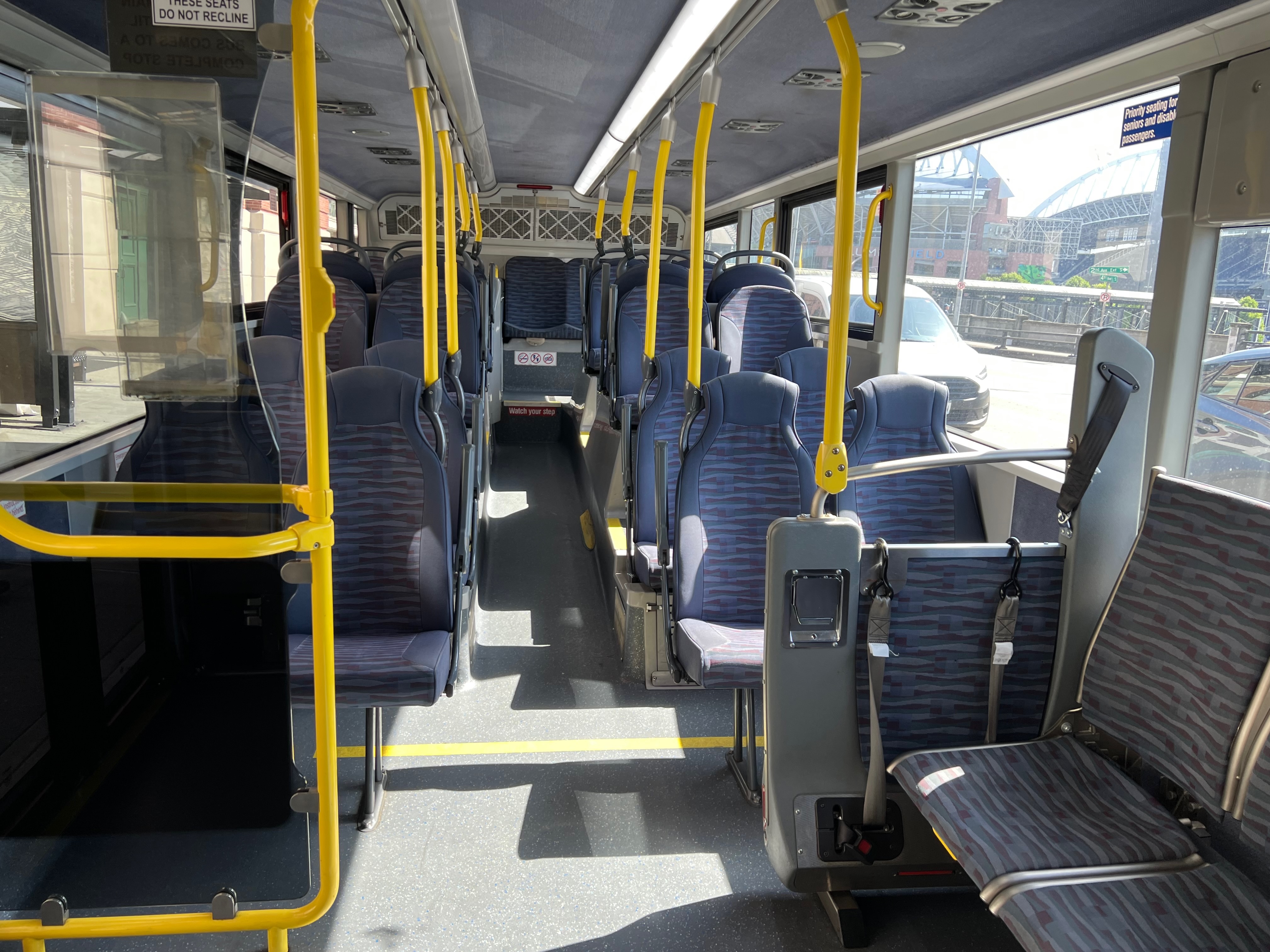
I believe it was the 4:15pm bus that I boarded between King Street Station and Union Station. I’d racked my bike, then stepped onto the bus, swiped my Orca card, took a video (see below) and climbed the steps upstairs.

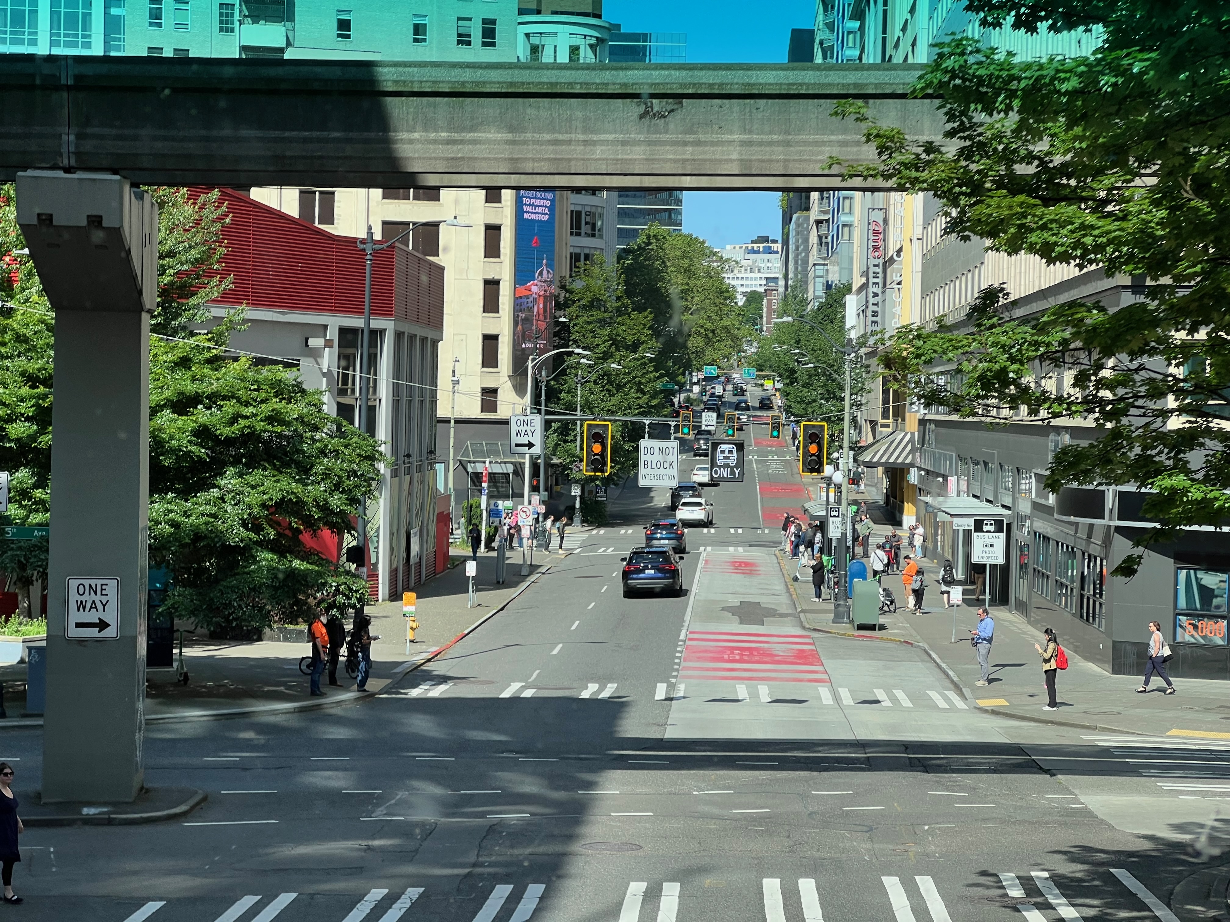
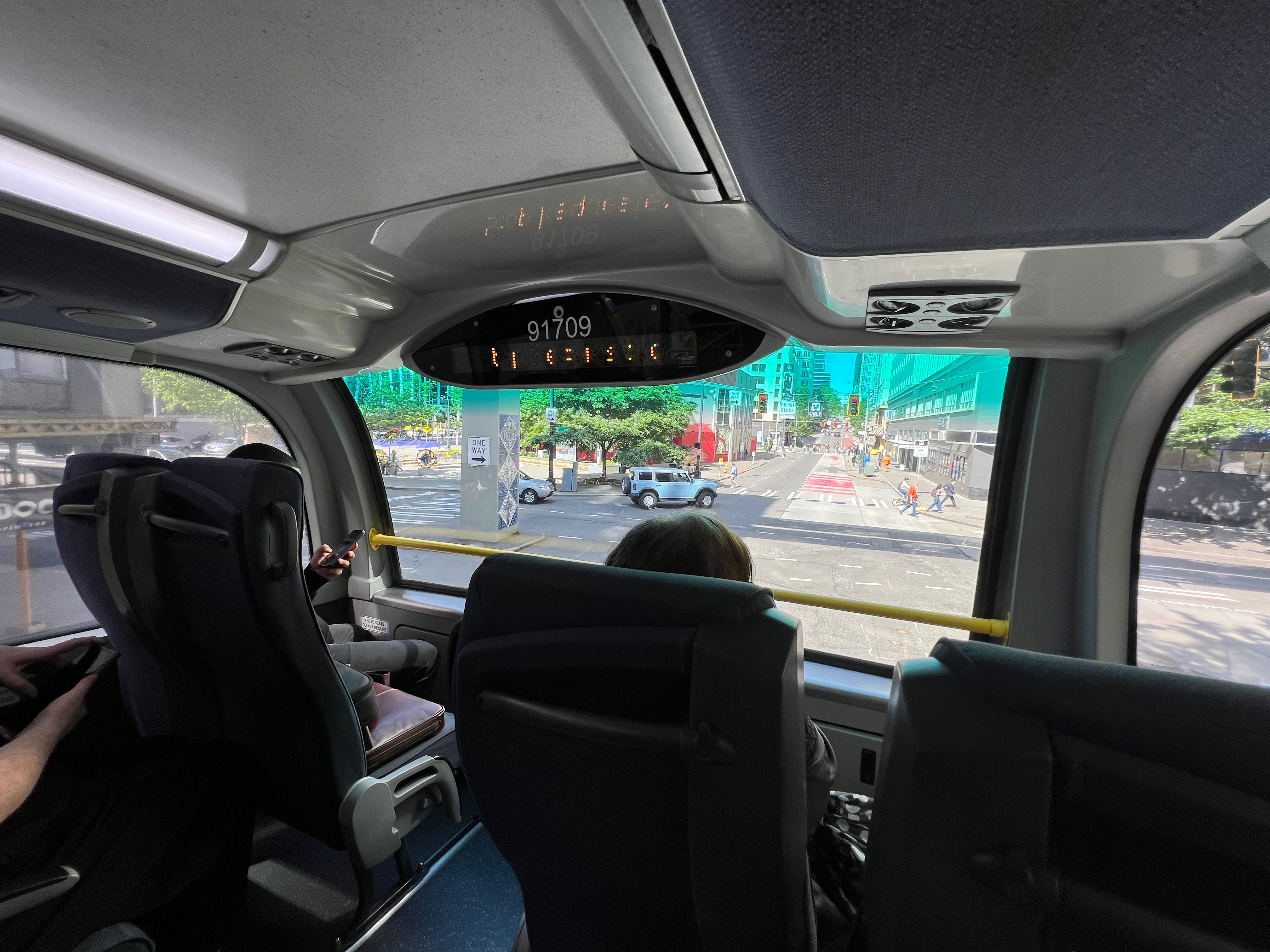
The bus then carefully, and very smoothly, traveled forth through the streets of Seattle. Slowly coming to and striking branches of trees because of the height. We stopped at about a dozen stops, from the originating stop I boarded at through to the egress point from downtown. When we left, we did it in relative style because we exited via the express lanes.

To note – when I showed the “empty” bus just after the first stop downtown, it was almost entirely full by the time we left downtown. Don’t get in your head that this is an empty route, it’s a very well used rush hour service. A kind of extra interlined service, in addition to the light rail and other Sound Transit Express lines that go out this way.

However, if you watch the video all the way through, you’ll notice the enjoyment of zooming along in the express lanes comes to an end before we even got past the Greenlake and Ravenna areas! Motorized “road” transportation without right of way is, and always will be a joke when it comes to speed and throughput.

But, that didn’t really matter much because being on a double decker, in a cool air conditioned environment with big ole’ windows to see as far as thee eye could see was a joy! We carried on, as you do, at a reasonable 20-35mph. The traffic slugged into a accodian like zig zag of slow drivers stuck behind entire cavalcades of other slow drivers under the guise of the inefficiencies and stupidities of mass transportation movement via single occupancy vehicles.

In other words, we were limited by the stupidity of cars as primary modal option at rush hour.

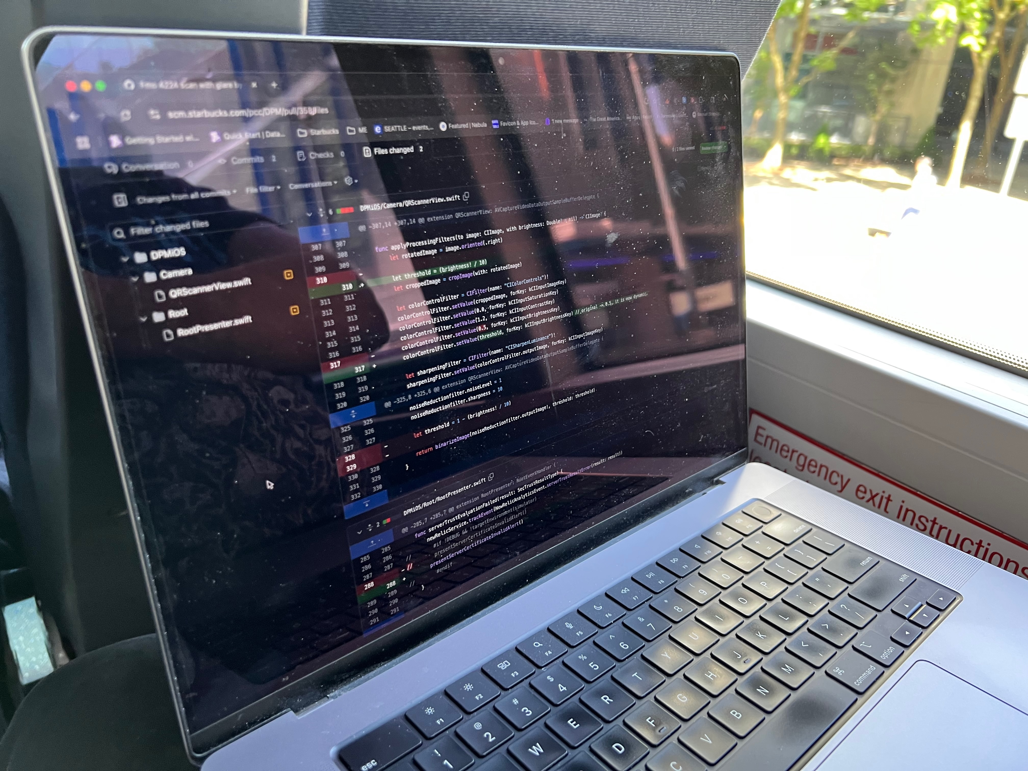
But it was entertaining and pleasant. I wrote up this blog entry and got some work done as I explored this new transportation choice for traveling north to Lynnwood.

At this point I also had zero idea what I would do once I got to Lynnwood, but I didn’t really care, I’d likely the board the Link Light Rail line back south and then take the 542 at University District back home.

The Bus Itself

The bus itself, being a double decker, is very smooth similar to one of those intercity buses. The air conditioner worked great, so it was a cool ride in spite of it being a bit warm outside.

Additional Observations

As we rolled forward and stopped, then moved forward again, and stopped, and then lurched and stopped, we made our way ever so slowly to Lynnwood. I couldn’t help but wonder, was this even faster than light rail with all this traffic? I had no idea, as I’d never even looked at the schedule vs. what time this was taking now.

At one point we just stopped for a solid 20+ seconds and sat. Traffic unmoving and a light rail train zipped by beside us, one going north full of people and one going south with a dramatically smaller number of people.

It really did seem like the light rail would have been the faster choice at this point. However this is likely the smoother option, considering how the double deckers ride! They really are not like other buses.

Drama!

In normal society fashion, at some point some guy got a phone call and began talking loudly – very “American” of him – about a financial situation that a child or someone in family was having difficulty with. He wanted to see funds and bank accounts and started “telling them” a number of things.

Why are people like this, what is the deal with the lack of situational awareness? So many parents bring up kids to become these adults that just utterly drives me nuts as a parent. I’ll take rowdy kids any day over an oblivious adult yapping drama out of the pie hole openly and loudly!

But even with that slight little interruption along the route, the ride was great. One more great way to commute in the Seattle area, so great I’d even put this up close right after “Ferries”, “Commuter Trains”, competitive with “Light Rail”, but definitely better than intercity buses!