Hop Fastpass, Getting to the Party

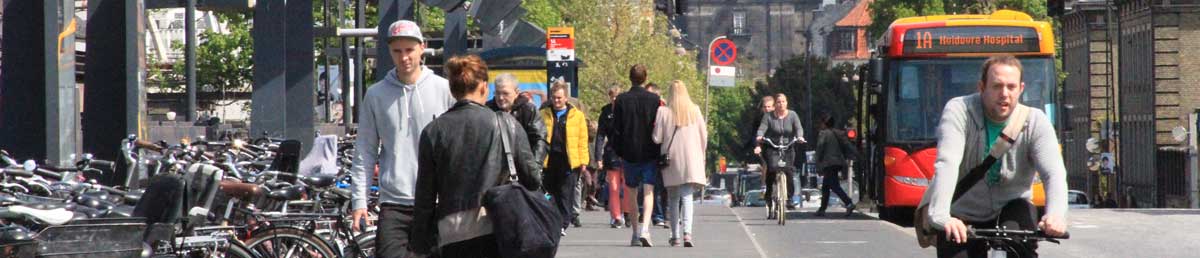
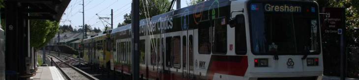
Even though Trimet is seriously late to the party (by almost a decade or more in some ways) with the Hop Fastness, let’s talk about why this is actually a good thing for the area. First, the issues with this form of payment.

Almost every major city in on the west coast has had a card payment system of this type for years now. They however didn’t just magically turn their payment systems on and install things to swipe them on and have them work. Oh no, there are long and storied tales of corruption, delay, and massive failure before they all became successful.

Here’s a few things to read up on ORCA, that’ll give you the lowdown on the many issues the Seattle area transit services fought through.

…and for some serious stories, a little searching and you’ll find a whole host of catastrophe associated with Clipper Card implementation in the Seattle area.

Even Yelp has threads on the matter of Clipper Cards!!!

Here’s the Wikipedia article on Clipper Card.

Los Angeles also has a card, but that’s enough of that. You get the idea, simply put there has been massive issues implementing and getting these interagency cards enabled. Fortunately they’ve done all the research and fought the battles. So hopefully when the Hop Fastpass is put into service Trimet will have a well oiled service offering come online. If Trimet does run into a few minor bumps, just keep in mind the colossal issues the other agencies on the west coast have had!

When I read the recent post on the Trimet Blog I do get excited about the simplified approach to paying fare. In all seriousness, this is the ideal way to handle payments. The card just keeps a certain amount on it, there’s a daily limit, and it just automatically rings up some more funds if it runs low. That way you don’t have to ever fiddle with transfers, reloading cards, fiddling with a phone that has a dying battery, or carrying around a paper ticket that expires! This can really save everybody a ton of time.

There are many other things that this card will enable, and I am looking forward to it. May my sleuthing become even easier and everybody’s fare paying become seamless! 😉

A Beautiful Ride into Portland and Tactical Urbanism Surprises

Today I rode into Portland as I’ve done thousands of times. Today I cycled across the Skirdmore Bridge over I-5, across Mississippi Street area and over to the Vancouver/Williams bike routes. As usual, at the hour I was riding into town there’s a decreasing number of people from the rush hour commute. A few cars, and 2x to 3x as many cyclists plying their way down Vancouver. I passed the New Seasons, made the red light and on through the hospital area onto the part of the route that is a gradual downhill for the next mile or so.

I cut over at Russel Street to the easier to navigate Flint Avenue. I rolled by the Ex Novo Brewery and looked over as a few people dropped of kids at the Harriet Tubman Middle School. I rolled around the parents as they attentively watched myself and other cyclists pass in the through area of the road. I always worry around schools since there are so many parents who tend to become distracted and run over their children, or in some cases pedestrians or cyclists trying to just go by.

As I rolled onward, still on the downhill segment of the ride I came to the mess of construction that has the Broadway Bridge closed to almost every mode (at some point or another it has been at least). Today it was closed to automobiles, streetcars, and any motorized transport, but one side was open for pedestrians and cyclists. So I entered the bridge and began the uphill climb to the west side of the bridge for the Broadway drop into downtown.

Since oncoming traffic lanes were closed to the bridge I went ahead and just veered to the left and cut over at Irving Street. I got a good view of the train station, looking majestic this morning with the wonderful blue sky for the backdrop. I zig-zagged over to Hoyt and then onto 3rd.

On 3rd the bike lane begins at Glisan and now continues all the way to Burnside, which is excellent to have a clear route like that. I continued toward Burnside, and as I came to the street the light turned green and I noticed orange traffic cones on either side of the bike lane. It looked a little odd, but as I rolled further I realized that they were labeled with PDX-trans-formation, which from Twitter I know is @PBOTrans. I rode through and had to stop though, because I wanted some pictures! This was the first time I’d actually found some of the tactical urbanism of @PBOTrans.

After I snapped my pictures I continued on, got some work done, finished several errands, and headed over to a coffee shop to wrap up some more work before the meetup tonight. While there I pulled up twitter to check out the account and lo and behold it seems that there were already a whole bunch of tweets and other people noticing them too! Here’s a few choice tweets below.

This is Not Rocket Science, It’s How to Get Around!

Recently I realized, we’re doing this wrong in America. It isn’t that we aren’t trying, and not that we’re building too much auto roadway, nor that we’re building bikes lanes or that we can’t get dedicated right of way for bicycles, nor that we’re building the wrong types of transit routes or using the wrong types of buses or too much light rail. We’re building, using, and expanding transportation in a horrible and haphazard way, this is clear, and this is the root of the problem.

Why The Dutch Have Superior Infrastructure

Spend a measly 6+ minutes to watch this video on how the Dutch got their cycling infrastructure. You’ll see many things we’re doing wrong, but…

You’ll notice the Dutch made the same horrifying mistake that we have in the United States in our cities. Starting at minute 1 in the video, they built solely for cars! Cars everywhere, they were rich, it would fix everything it seemed. Just tear down some old buildings and history and the life of the city, that’s all you need to do, is destroy a bunch of things for the cars to fit! (minute 1:20 in the video).

But then, the Dutch, unlike so many other supposedly civilized countries, called the slaughter of innocents what it was.

Stop Kindermoord!

The Dutch realized it for the endless murder and violence that it brings. The pollutions, sickness, and economic and environmental pain. The delays and excessive trips that one must take from sprawling out to build around the automobile and creating an auto-dependent culture.

But we’re still missing what actually gives them better infrastructure. Because it isn’t just that their bicycling infrastructure is great. They also have exceptional transit options and, it might be shocking, but many Dutch still drive. But they all have one thing in common that many Americans can’t understand – barely any of them sit in auto-traffic congestion everyday and barely any of them have a commute more than 24-26 minutes each way to work.

How many Americans spend about 20 minutes just sitting in stop and go traffic? I’m not sure of the exact numbers, but suffice it to say there are a lot.

The Dutch spend their commutes on trains, trams, and bicycles for the most part. A few Dutch actually drive a little ways to their work, rarely needing to stop at stop signs or four way stops. Largely because the Dutch don’t have many of these things and instead have fully operational and functional roundabouts.

But go beyond the Dutch. Most of Europe, at least Western Europe, understands and is working toward these types of options. They’re ridding themselves of auto-congestion and just removing the automobile from their inner cities.

But how are they doing that? Did they just realize that cars cause an unnecessary and uncomfortable strain on society as a whole? Well, some realization of that has helped. But that isn’t it. Is it that they are somehow magically superior in transportation intellect than Americans? Jokingly one might say yes. But that isn’t particularly it either.

The Axiom of a Solution

The solution is hiding in how these European countries (and even some places in the United States) organize their transportation. They build it in a systemic and complete way, not for one single mode. Starting from this vantage point, and realizing that roads are public spaces that all people can, should, and will use is key. Transportation organization, planning, operation, and the future of it must be centered around building a complete system around a full systemic thinking mindset.

We must build for all modes and prioritize accordingly. It really is the only way we’ll fix the eternal congestion people face, get people into and out of the places they need to be in a reasonable way, and above all it is the only way to really gain an increasing livability and standard of life in this country.

Solution: Systemic, All Inclusive, Structured Transportation Planning

Whatever fancy pants word someone wants to come up with for that, it doesn’t matter, it just needs implemented across the board and this haphazard – “build a thing for cars only” then “build a sidewalk here” and then “build a bikeway over here” and who knows where the hell it is all connected – nonsense must end if we’re to move forward!

I’ve got a lot more coming on this topic, including how to increase the throughput of automobiles – somewhat ironically – to how to make the transit system work better with minor funding changes or increases. Cheers to 2016 Portland, let’s start kicking some ass and really make this city work!

Transit Header Images

I’ve just cut up a bunch of header images and just thought I’d post them. Any favorites? The next round I’ll aim for a few buses since this primarily came out of my MAX photos from the last 8 years.

IMG_3986IMG_4059IMG_4036IMG_4510IMG_4003IMG_4497IMG_4101IMG_40592IMG_3987IMG_3944IMG_3943IMG_4464IMG_0314_2IMG_4462IMG_9721IMG_40032IMG_4007IMG_4102IMG_0280_2IMG_39442IMG_3979IMG_4035IMG_4456IMG_4116IMG_3992IMG_4065IMG_4002