Seattle to Portland High Speed Rail

One of China's High Speed Rail Stations

One of China’s High Speed Rail Stations

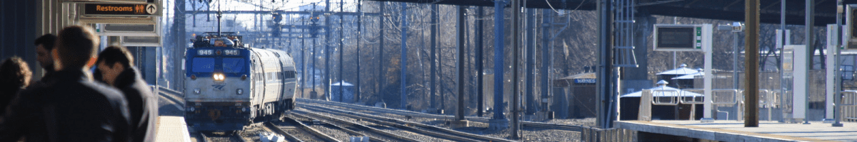
Currently travel times between the heart of Portland and the heart of Seattle look something like this. Google maps reports driving is 2 hours and 44 minutes. That’s with no traffic congestion. Flying theoretically takes 45 minutes, but that isn’t really to Seattle, it’s to SEATAC, which is nowhere near downtown Seattle. Taking the train takes a mind boggling 4 hours.

But seriously, those times are all a bit deceiving. Because of the unreliable nature of American transportation infrastructure and systems we end up with dramatically different averages. Driving is sometimes as low as 2 hours and 15 minutes, but regularly more than 3 hours if either end has traffic congestion. The train, if you take the Amtrak Cascades takes about 3 hours and 30 minutes, but on some rare occasions it actually makes the trip in 2 hours and 55 minutes when there’s no freight congestion. Flying is a joke if you need to get to the downtown core of Seattle or Portland. Getting to either airport from the city core takes somewhere between 20 minutes to an hour or more for each city. Again, it depends on the traffic and the mode. Using light rail on either end is a 30-35 minute trip to get downtown. So in the best case scenario, with arrival at the airport at least 1 hour before take off we’re talking about a 3 hour trip minimum, if not more. Putting air travel head to head with riding the train. There’s also the bus, which can take a variable amount of time but often similar to driving.

Vision for American High Speed Rail (Click for a great article on American high speed rail)

Vision for American High Speed Rail (Click for a great article on American high speed rail)

Now imagine for a moment if we had real high speed rail service from Union Station to King Street Station in Seattle. At a top speed of 200 mph, with the same stops that are currently in place, the travel time between stations would easily be covered in about an hour an 15 minutes. Maybe plus or minus 10 or 15 minutes. But either way, it would clearly be the fastest way to travel between the cities.

Just think about that type of travel between these cities. Think about what would be possible…

Portland Living, Seattle Jobs

All of a sudden, with a system like that in place it would open up the Seattle job market to thousands of more people in Portland and even introduce the possibility of living in Portland and working in Seattle. That’s a pretty crazy thought when one stops to think about it. A commute from Portland to Seattle would be no more than what a current commute from Tacoma to Seattle is via the Sounder Commuter rail, or some of the express buses from Everett or far eastern Bellevue or Redmond.

Suddenly, Portland would have the possibility of dramatically more business with Seattle, and obviously vice versa. It leaves one with a question of…

Why don’t we have high speed rail between these two cities?

It’s really kind of insane, and is representative of our ongoing paralysis in intelligent economic development between key cities in this country. Portland and Seattle are a prime example of this exact paralysis. The public sector can’t get it done. The private sector isn’t even allowed to touch the notion. It’s pure idiocy all the way down the decision flow.

As I see many people who live in Seattle, who would rather live in Portland, but are stuck living in Seattle because of the better work & career options this high speed rail thought always comes to mind. Also I imagine there are some people that might want to live in Seattle and work in Portland, but probably not. The general crux between these two cities is that Seattle has the good jobs, and Portland has the good life.

Now while you’re thinking that through, just imagine if we really managed to get our act together and include British Columbia and connect Vancouver. We’d effectively move into the realm of a serious powerhouse world class economic region of the world. Livability, jobs, and career options that exceed the rest of North America by many degrees.

I’d wrap up on these thoughts with a simple notion. Let’s kick some serious regional ass and get some high speed rail built. There’s no region we shouldn’t move into the next level in a serious way! It could start with the cities’ mayors getting together to start applying some real pressure on the respective states and nations to get their act together. It’s well past the time we should start building up the Cascadian Region in some serious ways, let’s stop piddling around and make this happen!

Denver, Los Angeles, Seattle and Portland, What Was First?

Portland was first, again, as usual it seems. What was it first for? Well, the list isn’t short, but what I’m talking about today is the MAX connection from downtown to the airport. I just read a summary of news tidbits on The Source titled Transportation Headlines for Wednesday, November 27th. The segment that caught my attention was the Denver East Corridor Rail line to the airport that pointed to the Streetsblog Article complaining about LA’s airport connector that is under construction.

Portland’s MAX Red Line

MAX Red Line, Click for Trimet's Page on the Red Line.

MAX Red Line, Click for Trimet’s Page on the Red Line.

In Portland the MAX Red Line opened in 2001 on the very unfortunate date of September 10th. The next day being September 11th 2001 really put the airport out of commission. For weeks after the opening date the line barely carried a soul to the airport, for obvious reasons. The entire place was closed after the world trade center twin towers came down in New York City. The world mourned the event and the Red Line suffered because of it, just as we all did.

However, as the city, the country and people got back to the business of day to day activities and the airport re-opened the line bustled with riders. Between 1990 and 2008 the airport had gone from six million passengers through the airport (flying) to over 13 million. 2020 projects are that it will easily surpass that, likely in the 20+ million range. The four stops of the Red Line however do not serve just the airport, and the length of the route serves many other stops with a huge number of riders. For those stops it doubles the service along the Banfield Corridor with the Blue Line all the way out to Beaverton. There is even talk of enabling it to double service even further out toward the edge of Beaverton or even going a little ways into Hillsboro. Time will tell for those changes though.

Why do I bring that up? Because the Red Line serves far more than just the airport, and even a bulk of the ridership isn’t even airport bound. The ridership for the two stops before the airport stop have boomed as retail has exploded around them. An Ikea opened, and along with a number of other retail options. These options benefit from a number of things including Oregon’s lack of a sales tax, creating a situation of thousands of Washington residents driving across the I-205 bridge to shop there. Many of these people drive across that same bridge in the morning commute and board the Red Line at the Parkrose/Sumner Transit Center stop. Some even sneak in and park at the Cascades stop (even though that’s retail parking for the businesses there, we know motorists rarely care nor know they’re not supposed to do that). Overall, all those stops in between the airport and where the line resumes service with the Blue Line (and now the Green Line too matter of fact) on the Banfield Corridor are hugely important.

Time for Some Data!

In 2010 I found some data Michael Anderson had gotten from Trimet for ons and offs. This is the counter data that all MAX trains have that count boardings and detrainings from the MAX Light Rail Vehicles (LRVs) at each stop. Remember this is 2010, ridership is up over 10% since 2010. So even correcting for the +-1% for data reading mistakes or anything like that, this data is a conservative look into what ridership is today in 2013.

Airport Station
Stop ID: 10579 On 1694 Off 1635

Mt Hood Avenue MAX Station
Stop ID: 10576 On 50 Off 253
Stop ID: 10577 On 252 Off 54

Cascades MAX Station has about 450 on and 450 off. Keep in mind, this was in 2010 when most of the retail wasn’t even open yet.
Stop ID: 10575 On 402 Off 46
Stop ID: 10574 On 43 Off 411

Parkrose/Sumner TC MAX Station, MAX Rides on and off only. There’s over a thousand on and a thousand leaving the station everyday, just on the Red Line.
Stop ID: 10572 On 113 Off 926
Stop ID: 10573 On 962 Off 134

The line is technically 5.5 miles long. This accounts for the Red Line segment that is entirely new, between Gateway TC and the PDX Airport. It was finished and opened for public ridership on September 10th, 2001. Here’s a map of the line, running from the airport to Beaverton today. When it originally opened it terminated downtown on the turnaround from the original Blue line that ran from Gresham to Portland. Now the turnaround isn’t used as an active turnaround, but as an area for train extras. The terminus is now on the middle track at Beaverton Transit Center.

The Trimet Rail System. Click for a larger image.

The Trimet Rail System. Click for a larger image.

Here’s some other stats of significance. The Red Line was the first train to plane service on the west coast. It was built through a public-private partnership, nothing seen like this for many decades (think pre-1950 when most transportation was nationalized). The funding split was Trimet general fund at 36%, Bechtel/Cascade Station Development Company, LLC at 23%, Port of Portland (for the airport) at 23% and the City of Portland at 18%. No federal dollars or new local taxes were used. This is of significant note, as with Federal dollars it would have likely taken 5-10 years longer to build, if it was even able to be completed then. Federal involvement always makes things dramatically more difficult to get shovels in the ground.

Why Mention This?

Well it seems, since the line was opened Seattle has open their Link Light Rail service from downtown Seattle to the airport. It serves about 22k people per day last I checked, which I’m betting it is up to about 28-32k per day now. It’s been a while since I checked. Los Angeles and Denver are about to join the ranks of cities in the United States west of the Mississippi to offer train to plane service. There has been some debate whether LA’s connector will be worth the investment and if Denver’s isn’t’ a better example.

My Bets for Denver

What I’m betting, contrary to the article fussing for a direct connection to downtown Los Angeles, is that most of the ridership for the Denver line will not actually originate at the airport. Almost all of the ridership I bet ends up being commuters in and out of the city from the 5 intermediary stops along the line. In addition, if empirical data is any proof, then most of the airport ridership will actually be local workers at the airport and not travelers going to flights. However, I counter that to some degree. So here’s my bullet point bets for the Denver line. This bet I’m making based on assumptions of what service will be and what ridership will be from 2016 when it opens until about 2020. After that, all bets are off.  😉

  1. Most of the riders will be commuters riding from the 5 intermediary stops into and out of Denver. More precisely riders originating from and to the 5 intermediary stops of: 38th and Blake, 40th and Colorado, Central Park, Peoria and Airport (rd/dr) and 40th will exceed 51% of all riders.
  2. A large percentage of the riders for the airport (into the actual final stop of the airport, not the Airport St & 40th stop) will be airport workers. I’ll estimate that at least ~12%. I wouldn’t bet against someone betting on 30-40% of the riders being workers at the airport. Ideally of course, only about 2-5% of the riders would be airport workers, as one would hope the rider count on the train will be very high.
  3. It will for the first 10 years be a significantly higher cost per ride then the light rail or bus service in the area. Over the 20-30 year period it will drop below thanks to inflationary cost changes and over a 30+ year it will drop below or be maintained at about the cost per ride of light rail and bus service. Pending of course we still even get around this way in 10-30 years from now. We might just use transporters and aircraft may be irrelevant.  😉

References:

Cuz’ The Northwest is Rocking the Cycling and Seattle is Starting to Lead the Pack!

Recently Seattle stepped up its game even more. Not only is a streetcar line soon to open between King Street Station, First Hill and Capital Hill but also a cycle track is going in on Broadway. I knew all about the streetcar line going in but holy moly I’d no idea they were getting a cycle track too. A trip will be scheduled and I’ll be aiming to bring some of the cycle track and streetcar action to you via Transit Sleuth TV once they’re both open! Here’s a sneak peek via Streetsblog.

The streetcar system is connecting three major points in Seattle, this is going to be a pretty big deal. Here’s a summary of the four places. For more official information about the streetcar service, check out Seattle Streetcar.

King Street Station @ Pioneer Square area to Chinatown then thru First Hill & Capital Hill

King Street Station is the Amtrak Station that has recently been returned to it’s proper magnificent glory of yesteryear. In some ways it is also the northern terminus for Sounder commuter rail service from Tacoma and the southern terminus for Sounder service to Everett. It’s a gorgeous station, worth a trip by itself. There are a number of other things in the Pioneer Square area of downtown Seattle that are worth checking out. This area along with King Street Station is basically the southern terminus of the line. The line then traverses part of the International District (or still commonly referred to as Chinatown in Seattle) and then turns in the First Hill area. It continues through the First Hill area and into Capital Hill, which is one of the dense urban areas of the city where music, art and livability thrive. It also is partly rooted to the future Link Light Rail Station for Capital Hill. This connection point is poised to be one of the busiest areas of the city in the coming years, easily transforming the very vibrancy and life of Seattle.

The Broadway Cycletrack

If there is a sure fire way to avoid streetcar tracks on a bike, it’s to have a cycle track right next to them! Seattle has planned for this and the Broadway Street segment is going to have just that. Here’s a cross cut view of the cycle track next to the streetcar and road traffic on Broadway.

Seattle Transportation Department also has more information about cycletracks going in around Seattle along with some information about ones elsewhere.

Coverage of Transit Sleuth TV Episode 1 & The Precursor, That Launched Transit Sleuth TV

Al M @alyourpalster at his blog “Introducing Transit Sleuth TV“, Dogcaught “Transit Sleuth TV” care of @steveeshom and Portland Transport’s “Open Thread for the Week of 9/15/13“, thanks @ChrisSmithUS. Also I want to give a big shout out and thanks to Paul Peterson of @EmpteFilms for helping me conjure up the idea to start Transit Sleuth TV. Thanks and cheers Paul, we’ll have to have a beer again soon and plot out a new episode!

In other coverage here’s a few of the tweets. Thanks to everybody for getting the word out on the first episode!

Sound Transit’s Link Light Rail opened a number of years ago. Paul and a crew of friends, transit advocates all, joined forces for a tour of the light rail opening. This was, as you can see if you watch the video, the precursor of Transit Sleuth TV. Thanks to Paul for filming and lighting the fire of the idea to start a project around this. Finally, I’ve got myself in gear and put the first episode together here: “Transit Meet & How to Carry Wine and Gelato“. In the near future Paul and I will probably team up to bring you some more Transit Sleuth TV. Stay tuned, for now here’s the original, from the opening of the Link Light Rail in Seattle.

Seattle Loses 17% of Transit Service

Ok, so it hasn’t happened yet. But as one would expect, more cuts are on the table. The Feds haven’t fixed the transit situation with funding options & the local cities & states just keep sucking money out into other solutions. It’s kind of par for the course. Seattle is threatened with a 17% loss in service. Most bus lines would lose one out of every bus. The only lines that would likely remain untouched would be a few of the Rapid Ride lines and high capacity runs during rush hour. But everything else is up for cutting.

What can you do about it as a citizen of Washington and Seattle? Go and message your elected leaders.

The US is seriously losing it’s ground right now, it’s happening fast. This is seriously getting interesting in some scary kinds of ways. Weigh in with your opinion, it may be the difference between standing in the cold, sitting in MORE traffic in Seattle or worse.